Natural Attractions in Botswana
Experience the stunning beauty, the unimaginable vastness, the isolation and other-worldiness, the astoundingly prolific wildlife of the best kept African secret – Botswana.
Makgadikgadi
Imagine – if you will – an area the size of Portugal, largely uninhabited by humans. Its stark, flat, featureless terrain stretches – it would seem – to eternity, meeting and fusing with a milky-blue horizon. This is the Makgadikgadi – an area of 12 000 sq kms, part of the Kalahari Basin, yet unique to it – one of the largest salt pans in the world.
For much of the year, most of this desolate area remains waterless and extremely arid; and large mammals are thus absent. But during and following years of good rain, the two largest pans – Sowa to the east and Ntwetwe to the west – flood, attracting wildlife – zebra and wildebeest on the grassy plains – and most spectacularly
flamingos at Sowa and Nata Sanctuary. Flamingo numbers can run into the tens – and sometimes – hundreds of thousands, and the spectacle can be completely overwhelming.
The rainwater that pours down on the pans is supplemented by seasonal river flows – the Nata, Tutume, Semowane and Mosetse Rivers in the east, and in years of exceptional rains, the Okavango via the Boteti River in the west.
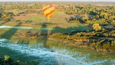
During this time, the pans can be transformed into a powder blue lake, the waters gently lapping the shorelines, and flowing over the pebble beaches – a clear indication of the gigantic, prehistoric lake the Makgadikgadi once was. Research suggests that the Makgadikgadi is a relic of what was once one of the biggest inland lakes Africa has ever had.
Africa’s most famous explorer, Dr. David Livingstone, crossed these pans in the 19th century, guided by a massive baobab, Chapman’s Tree – believed to be 3 000 to 4 000 years old, and the only landmark for hundreds of miles around. Seeing this amazing tree today, you are given entry to an era when much of the continent was uncharted, and explorers often risked their lives navigating the wilderness on oxcarts through rough and grueling terrain.
The Makgadikgadi is in fact a series of pans, the largest of which are Sowa and Ntwetwe, both of which are surrounded by a myriad of smaller pans. North of these two pans are Kudiakam pan, Nxai Pan and Kaucaca Pan. Interspersed between the pans are sand dunes, rocky islands and peninsulas, and desert terrain.
No vegetation can grow on the salty surface of the pans, but the fringes are covered with grasslands. Massive baobab trees populate some fringe areas – and their silhouettes create dramatic landscapes against a setting sun.
The Makgadikgadi Pans Game Reserve – with an area of 3 900 sq kms – incorporates the western end of Ntwetwe, extensive grasslands and acacia woodland. At its northern boundary, it meets the Nxai Pan National Park, separated only by the Nata- Maun Road.
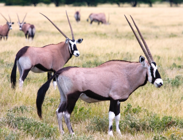
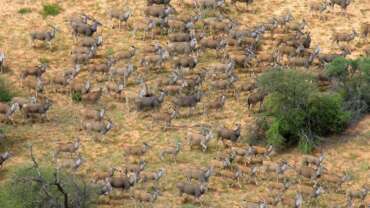
In the wet season, this reserve can offer good wildlife viewing, particularly when large herds of zebra and wildebeest begin their westward migration to the Boteti region. other species include gemsbok, eland and red hartebeest, as well as kudu, bushbuck, duiker, giraffe, springbok, steenbok, and even elephant, with all the accompanying predators, as well as the rare brown hyena.
Humans have inhabited areas of the pans since the Stone age, and have adapted to geographical and climatic changes as they have occurred. Archaeological sites on the pans are rich with Early Man’s tools, and the bones of the fish and animals he ate.
Human inhabitation has continued to the present day; and a number of villages, including Mopipi, Mmatshumo, Nata, Gweta and Rakops, are situated on the fringes of the pans.
Baines’ Baobabs
Approximately 30 kms from the Nxai Pan National Park entrance, Baines’ Baobabs are a highlight for any visitor travelling this area of Botswana.
Seven huge, gnarled baobab trees, named after the 19th century explorerThomas Baines, are situated on a promontory or island overlooking and surrounded by the white, crusty Kudiakam Pan. Baines stood here over a hundred years ago and painted this otherworldly scene. It has essentially remained unchanged.
Thomas Baines was an explorer, artist, naturalist and cartographer. He and fellow explorer James Chapman travelled through this area during their two-year journey from Namibia to Victoria Falls (1861-63).
They travelled in horse-drawn wagons and on foot, accompanied and led at different times by Hottentots, damaras (a tribe from Namibia) and San. They encountered numerous difficulties, including the harshness of the desert, thirst, hunger, illness, and more than once, desertion by their guides, who made off with their supplies.
Despite all this, Baines’ account of the journey is filled with appreciation of the beauty of africa. ‘I confess,’ he wrote, ‘I can never quite get over the feeling that the wonderful products of nature are objects to be admired rather than destroyed; and this, I am afraid, sometimes keeps me looking at a buck when i ought to be minding my hindsights.’
Baines’ painting of the small island of baobabs shows covered wagons, people tending their horses, and a huge baobab bursting with leaves. ‘We walked forward to the big tree, the Mowana at Mamu ka Hoorie, and found the country much improved,’ Baines wrote of the gloriously shaded area.
Baines’ diaries, sketches, drawings and paintings provide fascinating first-hand documentation of that most Africa. Decisive era in the history of Southern Africa.
Nxai Pan National Park
Part of the great Makgadikgadi complex, Nxai Pan National Park covers an area of 2 100 sq kms, and comprises several larger pans – Nxai Pan, Kgama-Kgama Pan and Kudiakam Pan, which were once ancient salt lakes. These larger pans are now grassed, and are scattered with islands of acacia trees, and smaller pans that fill with water during the rainy season – thus providing rich resources for wildlife.
Wildlife viewing is seasonal, and dependent on if and when the rains come, and when animals migrate. There are several artificial watering points. If the rains have been good, December to April is the best time to visit.
Common species to be sighted are zebra, wildebeest, springbok, impala, gemsbok, hartebeest, giraffe, lion, cheetah, wild dog, brown hyena, bateared fox, and sometimes elephant and buffalo.
The park is one of the more accessible areas of the Makgadikgadi, a mere 50 kms from the Nata-Maun Road.
Nata Sanctuary
Botswana’s first community-based conservation project is managed and staffed by residents of four local communities – Nata, Maphosa, Sepako and Manxotae. It is a good example of a non-consumptive means of wildlife utilisation that brings direct financial benefit to local communities. Proceeds from tourism activities in the sanctuary are shared by the four communities for whatever development projects they decide they want and need.
About 3 000 head of cattle belonging to members of these four communities were voluntarily moved out of the area for the establishment of the sanctuary. Nata Sanctuary opened its gates to the public in 1993, and in the same year was awarded the Tourism for Tomorrow award for the southern hemisphere.
Covering an area of 250 sq kms – comprising both grasslands and pans, in an important environmentally sensitive area – the sanctuary offers easy access to the pans, and pleasant, reasonably priced camping facilities.
In the peak season, birding, and even game viewing, can be good. When there is water in the pans, thousands of flamingos, pelicans, ducks and geese congregate, and the scene is indeed awe-inspiring. an elevated hide provides an unbeatable panorama of the pans.
Khutse Game Reserve
Because of its proximity, and relative accessibility, to the nation’s capital, Khutse game Reserve is a favourite retreat for Gaborone visitors or residents. The 240 kms drive takes the traveller through a number of interesting Kalahari villages, including the ‘gateway to the Kalahari,’ Molepolole.
Adjoining the Central Kalahari Game Reserve to the north, and with no fences separating the two, the terrain of the 2 500 sq kms reserve combines most types of Kalahari habitat – rolling grasslands, river beds, fossil dunes and grassed and bare pans.
The reserve is part of an ancient river system that once flowed northeast to fill the prehistoric Lake Makgadikgadi. Khutse’s Pans and dry river valleys are remnants of this river system.
Officially declared a protected area in 1971, Khutse (meaning ‘place where you can kneel down and drink’) was the second game reserve in Botswana to be established on tribal land (Moremi game Reserve in the Okavango was the first).
There is a series of rather picturesque pans (signposted) where wildlife often congregate, particularly during and following good rains; and indeed game drives are focused around the pans. These include the Motailane, Moreswa and Molose pans. Sometimes water is pumped at artificial waterholes at Moreswa and Molose, making for good game viewing year round.
Animals commonly sighted include springbok (often in abundance), gemsbok (often common), giraffe, wildebeest, hartebeest, kudu, black-backed jackal, steenbok, duiker, and the accompanying predators lion, leopard, cheetah, smaller cats, and the endangered brown hyena.
There are several delightful loops worth driving through the reserve. The shorter drive is the northern loop around Sekhushwe and Mohurusile pans, approximately 24 kms from the reserve headquarters. The longer drive is to Moreswa Pan, about 64 kms from the headquarters, or a 120 kms loop.
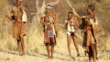
The San and Bakgalagadi peoples – the Kgalagadi’s original inhabitants – live in small villages on the periphery of the reserve. Their traditional arts and crafts can usually be purchased here; and walks with the San can be arranged at the Khutse Kalahari Lodge, about 10 kms before the reserve entrance.
Matsieng Footprints
Further north on the main road, just after the village of Rasesa, this National Monument consists of a slab of sandstone pierced by two deep holes, as well as engravings. Legend says that the first ancestor of the Batswana, Matsieng – a giant, one-legged man, climbed out of one hole, followed by his people, their domestic animals, and wildlife. The engravings – now very faint – were probably made by Khoe herders, and date to the beginning of the second millennium.
Linyati, Selinda and Kwando
At the extreme northern reaches of Botswana – the Caprivi just on the other side – lie three of the most splendid, wild and secluded destinations the country has to offer.
Sandwiched between the Chobe National Park to the east and the Okavango south, the extensive Kwando, Selinda and Linyanti concessions offer superb wildlife viewing – and terrain to rival the physical beauty of the Okavango.
And no wonder – both share geographical similarities. Like the Okavango River, the Kwando River flows south from Angola across the Caprivi Strip and into Botswana. Like the Okavango, it slowly fills the Linyanti Swamps. The outflow from the Swamps then fills the Linyanti River, which courses east into the Chobe River.
The swamps that fan out from the rivers carry the same magnificent natural history as the Okavango – picturesque channels, lagoons, papyrus stands and reedbeds. Riparian forest lines the waterways, giving rise to magnificent, towering trees. Dry riverbeds – the Selinda Spillway and the Savuté channel – meet the swamps, their lack of flowing water possibly determined by faulting underground that halts the course of the waters. interestingly, faults in this area are believed to be the southernmost point of Africa’s Great Rift Valley.
The reserves string along the rivers, with the Kwando to the northwest, Selinda (1350 sq kms in area) south and Linyanti (1250 sq kms in area) east. A small area of the Chobe National Park juts up to meet the Linyanti River and swamps; it has a government campsite and facilities for the self-drive camper, while the concessions offer private camps.
This is real African big game country, and during the dry season the permanent waters of both the Kwando and Linyanti Rivers serve as important migration points for wildlife from much of northern Botswana – including large herds of buffalo and elephant, wildebeest and zebra.
Virtually all naturally occurring antelope and predators can be seen in these concessions, depending, of course, on the season, and food and water availability. These include waterbuck, reedbuck, giraffe, impala, kudu, and with any luck the rare and shy sitatunga, and accompanying lion, hyena, leopard, cheetah, jackal, serval and caracal.
But perhaps the greatest attraction of this part of Botswana is the feeling it gives of extreme isolation, and being completely removed from the world as we know it. The camps are small and private, with perhaps only twenty or so guests present at one time.
There’s nothing else out there – except you, the bush and a fascinating contingent of wild animals – just waiting to be discovered, and explored.
Mokolodi Nature Reserve
For nature and wildlife lovers, Mokolodi is the closest excursion from Gaborone that offers a wide variety of activities for the entire family. Situated approximately 10 kilometres south of Game City, on the main Lobatse Road, the five-square kilometre reserve is comprised of riverine terrain interspersed with rocky hills, with the very picturesque Lake Gwithian and adjoining picnic site.
Mokolodi offers game drives, guided walks, horse-back safari, rhino tracking, giraffe tracking, walks with trained elephants, and cheetah visits. It holds regularly scheduled lectures, as well as annual events, such as Easter and Christmas day excursions for children, and the Mokolodi Photography Competition.
Wildlife resident in the reserve include kudu, warthog, duiker, giraffe, steenbok, zebra, blue wildebeest, gemsbok, ostrich, impala, springbok, waterbuck, baboons, vervet monkeys, mountain reedbuck, eland, bushbuck and leopard. A highly successful white rhino reintroduction and breeding programme now puts the white rhino population in the reserve at eight.
Mokolodi also houses a reptile park, and a wildlife sanctuary for disabled or orphaned animals that for one reason or another cannot be returned to the wild, and an animal clinic that treats sick or injured animals.
Facilities include camping sites, chalets, picnic sites, an education centre, museum and library, the World’s View Conference and Function Centre, The Alexander McCall Smith Traditional Rest Camp, as well as a lovely stone and thatch restaurant that gives a beautiful view of the surrounding bush.
Environmental education for Botswana children is a major mandate of the nature reserve; and each year thousands of schoolchildren come for courses, sleeping in the dormitories, or on camp outs.
Moremi Game Reserve
This gem of a National Park has garnered a number of important distinctions. in 2008, it was voted the ‘best game reserve in Africa’ by the prestigious African Travel and Tourism Association at South Africa’s premier tourism fair, Indaba.
It is the first reserve in Africa that was established by local residents. Concerned about the rapid depletion of wildlife in their ancestral lands – due to uncontrolled hunting and cattle encroachment – the Batawana people of Ngamiland, under the leadership of the deceased Chief Moremi III’s wife, Mrs. Moremi, took the bold initiative to proclaim Moremi a game reserve in 1963.
It is the only officially protected area of the Okavango Delta, and as such holds tremendous scientific, environmental and conservation importance.
And, undoubtedly, Moremi ranks as one of the most beautiful reserves in Africa, possibly in the world.
Moremi Game Reserve is situated in the central and eastern areas of the Okavango, and includes the Moremi Tongue and chief’s island, boasting one of the richest and most diverse ecosystems on the continent.
This makes for spectacular game viewing and bird watching, including all major naturally occurring herbivore and carnivore species in the region, and over 400 species of birds, many migratory and some endangered. Both Black and White Rhino have recently been re-introduced, now making the reserve a ‘Big Five’ destination.
Contained within an area of approximately 3900 sq kms, here land and Delta meet to create an exceedingly picturesque preserve of floodplains – either seasonally or perennially wet, waterways, lagoons, pools, pans, grasslands and riparian, riverine and mophane forests. This terrain makes driving Moremi’s many loops and trails both delightful and, at times, totally inspiring.
Moremi is a very popular destination for the self-drive camper, and is often combined with the Chobe National Park to the northeast.
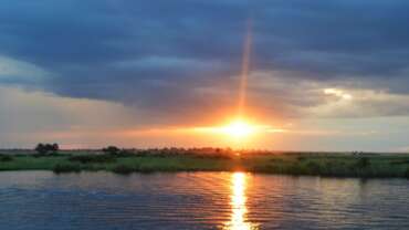
The rustic Third Bridge campsite, situated near the pretty Sekiri River, flanked with thick stands of papyrus, is a favourite, creating lasting memories of resplendent Okavango sunsets.
Central Kalahari Game Reserve
Nothing prepares you for the immensity of this reserve, nor its wild, mysterious beauty. There is the immediate impression of unending space, and having the entire reserve to yourself.
Waist-high golden grasses seem to stretch interminably, punctuated by dwarfed trees and scrub bushes. Wide and empty pans appear as vast white stretches of saucer-flat earth, meeting a soft, blue-white sky. At night the stars utterly dominate the land; their brilliance and immediacy are totally arresting.
The Central Kalahari game Reserve (CKGR) is the largest, most remotely situated reserve in Southern Africa, and the second largest wildlife reserve in the world, encompassing 52 800 sq kms.
During and shortly after good summer rains, the flat grasslands of the reserve’s northern reaches teem with wildlife, which gather at the best grazing areas. These include large herds of springbok and gemsbok, as well as wildebeest, hartebeest, eland and giraffe.
At other times of the year, when the animals are more sparsely distributed, the experience of travelling through truly untouched wilderness, of seemingly unending dimensions, is the draw.
The landscape is dominated by silver terminalia sandveldt, Kalahari sand acacias, and Kalahari appleleaf, interspersed with grasslands, and dotted with occasional sand dunes, pans and shallow fossil river valleys.
CKGR is unique in that it was originally established (in 1961) with the intention of serving as a place of sanctuary for the San, in the heart of the Kalahari (and Botswana), where they could live their traditional hunter/ gatherer way of life, without intrusion, or influence, from the outside world.
The reserve was closed for about 30 years, until in the 1980s and 1990s, both self-drive and organised tours were allowed in, albeit in small, tightly controlled numbers.
The Botswana government has initiated plans to develop tourism away from the Okavango and Chobe areas, and has allocated concessions for lodge construction, both at the peripheries of and inside the reserve, allowing for fly-in tourists.
The northern deception valley is one of the highlights, principally because of the dense concentrations of herbivores its sweet grasses attract during and after the rainy season (and of course the accompanying predators). It is also the most travelled area of the reserve, with a number of public campsites, and proximity to the eastern Matswere Gate. The other two gates are completely at the other side of the reserve, at Xade and Tsau, where public campsites are also available.
Other worthwhile areas to drive are Sunday and Leopard Pans, north of Deception Valley, Passarge Valley, and, further south, Piper’s Pan.
Kasane
The gateway to Chobe National Park, Kasane is an important point of debarkation for the nearby Victoria Falls in Zimbabwe and Livingstone in Zambia, and Namibia’s Caprivi Strip. Impressive!
Spread out along the banks of the Chobe River, Kasane presents an array of hotels, guest houses and campsites that accommodate all the visitors to the national park. Some are splendidly situated, with wonderful views of the river and its wildlife. Often visitors opt to have a morning game drive and an afternoon boat cruise, with an afternoon game drive the following day, as this is the time of day when elephants are usually spotted.
Another option is a day trip to Victoria Falls, which is about 80 kilometres from Kasane. Kasane now boasts small shopping malls where all basic commodities can be purchased, and arts and crafts shops. While its main attraction is the park that lies a mere 10 kilometres away, there are nevertheless attractions in and around the town.
Khama Rhino Sanctuary
Affording the opportunity to see both black and white rhino – as well as an abundance of other wildlife species – the Khama Rhino Sanctuary (KRS) is a delightful stopover for tourists travelling by road to Botswana’s northern reserves, or an ideal weekend getaway for Gaborone or Francistown visitors or residents.
A mere 20 kms from the historically important village of Serowe, the accessibility of KRS is also a draw. This community tourism project, managed and staffed by local village residents, offers game drives, birding, bush walks, and arts and crafts shopping. It also has an education centre where many young children from all over Botswana come for environmental education, as well as a fun time in the bush.
KRS was established in 1989 due to growing concern over the then escalating rhino poaching situation in Botswana. Both black and white rhino – once abundant in Botswana – were during the early 1980s on the brink of local extinction, despite their having been granted protected status as far back as 1922.
Led by the Bangwato paramount Chief, the then Lt. Gen. Seretse Khama Ian Khama, and other conservationists, the people of Serowe conceived the idea to form a sanctuary to protect the remaining rhinos in Botswana, and hopefully give them safe haven to reproduce and gain numbers.
The first four white rhinos were reintroduced into the sanctuary from the Chobe National Park in 1992. Eight more rhinos came from the North West National Parks in South Africa.
The highly endangered black rhino was re-introduced in 2002.
The gamble paid off , and both species are doing well, under the watchful eye of sanctuary staff as well as the Botswana Defence Force (BDF), who assist with the constant patrolling of the sanctuary’s borders.
To date, KRS has 35 white rhino, and is serving as a source for their re-introduction back to the Moremi Game Reserve, the Makgadikgadi, the Northern Tuli Game Reserve, and elsewhere. And – much to the credit of KRS staff – the male and female black rhinos have mated, and the sanctuary’s first baby black rhino was born in 2008!
Gcwihaba Caves and Aha Hills
Certainly one of the wildest and most remote destinations in Botswana, Gcwihaba is a fascinating underground labyrinth of caverns and pits, linked passages, fantastical stalagmite and stalactite formations, and beautifully coloured flowstones that appear like waterfalls of rock.
Moving from the more commonly used northern entrance, you’ll first come across thousands of bats hanging upside down from the cave walls. The most common species are the commerson’s Leaf-nosed Bat – the largest insectivorous bat in Southern Africa, the tiny Dent’s Horseshoe Bat and the Egyptian Slit-faced Bat. They are harmless, but as you approach, be prepared for a possible mass exodus– clouds of screeching, fleeing bats winging through the dusty darkness.
Some caverns are up to 10 metres high, some are so tiny that one needs to squeeze, or crawl on the belly, to get through them; and some stalactites measure up to six metres in height, meeting their cousin stalagmites to form organic columns that seem to support the entire cave roof.
The main cavern is called ‘Drotsky’s cavern,’ named after the Ghanzi farmer Martinus Drotsky, who was the fi rst European to be shown the caves by the !Kung San in 1934.
Situated on a sand ridge set amongst undulating dunes, Gcwihaba has been part of the Kalahari ecosystem for almost three million years. It was formed during the pleistocene Age when the area was much wetter. There have been dramatic climatic variations alternating very wet with very dry periods.
Unique ecosystems of flora and fauna have been recorded at Gcwihaba. These include the Namaqua Fig, only found at these hills and easily recognisable by its long trailing roots, the endemic aloe, tent tortoises, barking geckos, Ruepel’s parrot (also unique to this region) and barn owls which live in the caves.
Archaeological evidence suggests that the area was inhabited by foraging peoples thousands of years ago. Late Stone Age tools, burnt ostrich eggshells, animal bones, even a fossilised primate skull, have been unearthed in the region. Indeed the caves hold important clues to the way prehistoric peoples related to their environments.
Gcwihaba is a designated National Monument and a proposed UNESCO World Heritage Site.
Aha Hills
Straddling the Botswana/Namibia border, the Aha Hills lie about 50 kms northwest of Gcwihaba, and are visible from it. The Aha Hills are mostly rough and jagged, having been split by weathering into numerous faults and fractures. They cover an area of approximately 245 sq kms, mostly in Botswana.


