Heritage of Mauritania
Prehistoric sites and cultural aspects
Mauritania has a rich prehistoric cultural heritage. Engravings and paintings are encountered on privileged sites: higher areas such as the massif of the Mauritanian Adrar and well preserved villages that extend along the cliff of Dhar between Oualata and Tichit which were described in particular by Theodore Monod.
– Tichit
According to the oral tradition re-quoted by renowned historians, the city of Tichitt would have been rebuilt several times on its own ruins. The current city is built on the superimposed rubbles of seven other cities.
Providing, at the beginning, a place of rest for salt caravans crossing the desert between Ouadane, Oualata and Tombuktu, Tichitt became, in the middle of the sixteenth century, an unavoidable step in the caravan route.
– The coastline
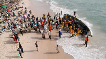
The Mauritanian coastline extends nearly from the island of Cap Blanc (Wilaya of Nouadhibou) to the estuary of the Senegal River (Ndiago), on almost 750 km of sandy coast in the form of a succession of beaches suitable for seaside and sports activities development, including big-game fishing and wind surfing.
This is particularly the case of the Banc d’Arguin Park, from Nouamghar to Cape Timiris via Tanit Bay and the Nouakchott area, and to the north of the park around Nouadhibou, where already exist a camp, whose purpose is to host big-game fishermen.
– Oualata
Located in the south-east of Mauritania, 120 km from Néma, Oualata is listed as a UNESCO World Heritage Site. Founded in the 8th century, it is called by the ancient travelers “the shore of eternity”. Its remarkable architecture makes it one of the most beautiful Mauritanian cities.
For centuries, Oualata has also been a spiritual center of Islam. Precious manuscripts are kept there and many students attend classes taught by renowned scholars.
– The inchiri
Located between the Atiantic Ocean in the south-west, and the beautiful regions of Adrar, Tiris, Dakhlet-Nouadhibou in the North and North-East, and the Trarza in the South, the legendary Inchiri region extends over 46800 km2 subjected to the combined influence of the trade winds, the continental trade winds and the monsoon. Along the Amatlich massif, the accumulation of water in the clay zones allows agriculture in the Great Grayrs, despite a climate and relief of Saharan types. The movement of the dunes miraculously makes the wonderful Benichab groundwater with its mineral water renowned and exported outside the country.
– The river
Much of southern Mauritania is bordered by the Senegal River which forms a border of about 800 km that could be the subject of river cruises. The river stretches in the plains of Guidimakha, Gorgol, Brakna and Trarza in the south of the country whose populations ways of life are different from the rest of the country.
The population is rich in its historical diversity: all ethnic groups “Moorish, Peulh, Wolof and Soninké” coexist and melt there harmoniously since centuries…


