Amazonas
Covering 175,500km², the state of Amazonas comprises over 20% of Venezuelan territory. Extending south from the convergence of the Río Orinoco and Río Meta, the state is bordered by Colombia to the west and Brazil to the east. With its dense jungles, maze of rivers and scattered tepuis, Amazonas is one of the most biodiverse and least explored regions of the world.
The Wild Amazonas
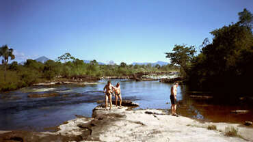
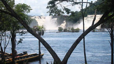
Tropical rainforest covers most of Amazonas’ western lowlands and is home to a variety of flora including lianas, strangler figs, bromeliads, tree ferns, orchids, lichens and mosses. The dense jungle landscape is interrupted only by swamps, waterways and flat-topped mountains known as tepuis, whose isolated surfaces are home to many rare and endemic plant species. Eastern Amazonas is dominated by the forested mountains of the Sierranía La Neblina. The waterways of the region are mainly the headwaters of the Orinoco, which flows northwest from its source in the Sierra Parima mountains on the Brazilian border. On the cusp of both the Orinoco basin and the Amazon basin lies the Río Brazo Casiquiare, the only waterway to feed both these great rivers.
The luxuriant forests are home to an exotic array of fauna, including mammals such as manatee, fresh water dolphins, giant otters, capuchin, red howler and woolly monkeys, jaguar, puma, ocelot, tapir, brocket deer, agouti and armadillo. The forests are also teeming with bird species such as macaws, parrots, toucans, parakeets, tinamou, contingas and hummingbirds. A diversity of reptiles and amphibians also inhabit the region.
Climate
In the north, the dry season is from December to April, and the rainy season from April to November. The temperature peaks in April, reaching 24-30ºC. Further south, the dry season becomes shorter and less distinct.
Puerto Ayacucho
Puerto Ayacucho is the state capital. With a population of 74,000, it is home to nearly 93% of the region’s population. Located about 70km south of the convergence of the Orinoco and the Meta, the town has the only overland link with Amazonas and is the commercial hub of the region. The capital, together with the town of Samariapo, was established in 1924 to provide a road bypass for the treacherous Maripure rapids on the Orinoco. This road, which marks the division between the upper and lower Orinoco, was an essential connection in the transport of goods up and down the river. The town, isolated bar a single dirt track running north, remained little more than a link in the chain. However, in 1980, the road was paved and river transport replaced with overland transport, bringing prosperity to the town and transforming it into the commercial center it is today.
Tourism
Several sites of interest are dotted around Puerto Ayacucho, including a museum, a cathedral and local markets selling Indian artesania of every description. Within walking distance are the two most popular tepuis, Cerro Perico and El Mirador, both of which have breathtaking panoramic views. A short por puesto trip away is La Parque Tobogán de la Selva, a natural waterslide and popular weekend destination among locals. Also nearby are the beautiful waters of Pozo Azul and the pre-Colombian petroglyphs of Cerro Pintado.
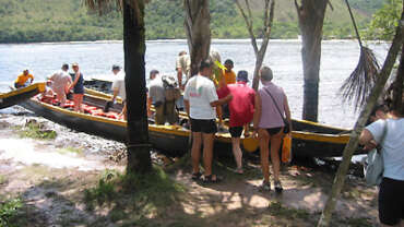
Puerto Ayacucho is also the best place to organize tours into Amazonas. Accommodation is easy to find and there is a good selection of tour operators offering a wide range of trips to a number of locations. One of the most popular is to the Cerro Autana, the sacred mountain of the Piaroa Indians. Located 80km south of the capital, the tepui plateau covers an area of 480ha and reaches a height of 1,400m. The vertical sides are pock marked with caves and galleries, the largest of which cuts right through the mountain. Deals may encompass 1-10 day trips with accommodation ranging from sheltered hammocks to private cabins with running water. Common activities include boat tours, trips to the tepuis, flights over the stunning landscapes, hiking, mountaineering and white water rafting.
Puerto Ayacucho can be reached overland by bus or by air from Caracas, Ciudad Bolivar and San Fernando de Apure. Light aircraft also fly to smaller settlements in the region. Brazil can be reached by air, and Colombia by ferry to Casurito.
Tours in Amazonas also operate from San Fernando de Atabapo and San Carlos de Río Negro, both of which can be reached by air from Puerto Ayacucho. In the northeast, San Juan de Manapíare has accommodation and tours to the surrounding region. Visiting the upper Orinoco is only possible with special permits as it is part of the protected Yanomani homelands.
Indigenous Tribes
Indigenous communities are scattered throughout the state, and more groups live here than anywhere else in Venezuela. Three large tribes, the Yanomani, Piaroa and Guajibo comprise more than 70% of the area’s 40,000 Indian population. Until European explorers first penetrated the thick jungle in the 1800s, the tribes lived as they had done for thousands of years in complete isolation. Suddenly exposed to the conflict and diseases of the outside world, many Indians perished. Since the early 1900s, their numbers have decreased by 50%. Today, the remaining Yanomani Indians number 12,500. One of the few existing Neolithic tribes, the Yanomami live in large communities of up to 400 centered around a circular shelter or Yano, and have retained the traditions and ways of life of their ancestors more than any other Indian group. Though they were granted legal protection in 1988 and their homelands recognized in 1992, the existence and lands of the Yanomani continue to be threatened by illegal developers and gold diggers from Brazil.
National Parks of the Amazonas
The four national parks of Amazonas (Yapacana, Duida-Marahuaca, Parima-Tapirapecó and Serranía La Neblina) together protect 6 million hectares of the region. However, all, with the exception of Duida-Marahuaca, have restricted access and can only be entered by those undertaking scientific research.
Yapacana National Park
Located in the mid-west of the state, Yapacana National Park encompasses Venezuela’s highest plain; perhaps the highest in the world. The unique plateau rises abruptly from the surrounding lowlands to 1,345m and is inhabited by an enormity of endemic flora and fauna, including 46 species of herpitofauna.
Duida-Marahuaca National park
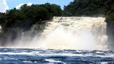
Duida-Marahuaca National Park lies in the center of the state. Notable features include the tepuis of Huachamakari and Duida-Marahuaca, the beautiful waterfalls of the Río Cunucunuma and various petroglyphs. The park is also a haven for birdwatchers, and can be reached by boat along the Iguapo, Padamo and Cunucunuma rivers. The nearest airstrips are at Esmerelda and Comunidad de Culebra.
Parima-Tapirapecó National Park
Parima-Tapirapecó National Park covers the entire southeast portion of the state. With a total area of 3,900,000ha, it is the fifth largest national park in the world. Almost all the Yanomaní of Venezuela live within its boundaries, for which access to the area is restricted. The park is also home to the source and headwaters of the Orinoco and the Sierra Parima mountains.
Serranía La Neblina National Park
Serranía La Neblina National Park lies on the southern tip of the state and comprises the Serranía La Neblina mountain range. The range peaks at 3,040m with the Pico La Neblina, Latin America’s tallest non-Andean mountain and the largest tepui in on Earth. The massive tepui is all but sliced in two by the Cañon Grande del Río Baría, one of the deepest canyons in the world. The park, along with Parima-Tapirapecó is part of the Alto-Orinoco-Casiquiare Biosphere Reserve.


