Cruising in Grenada
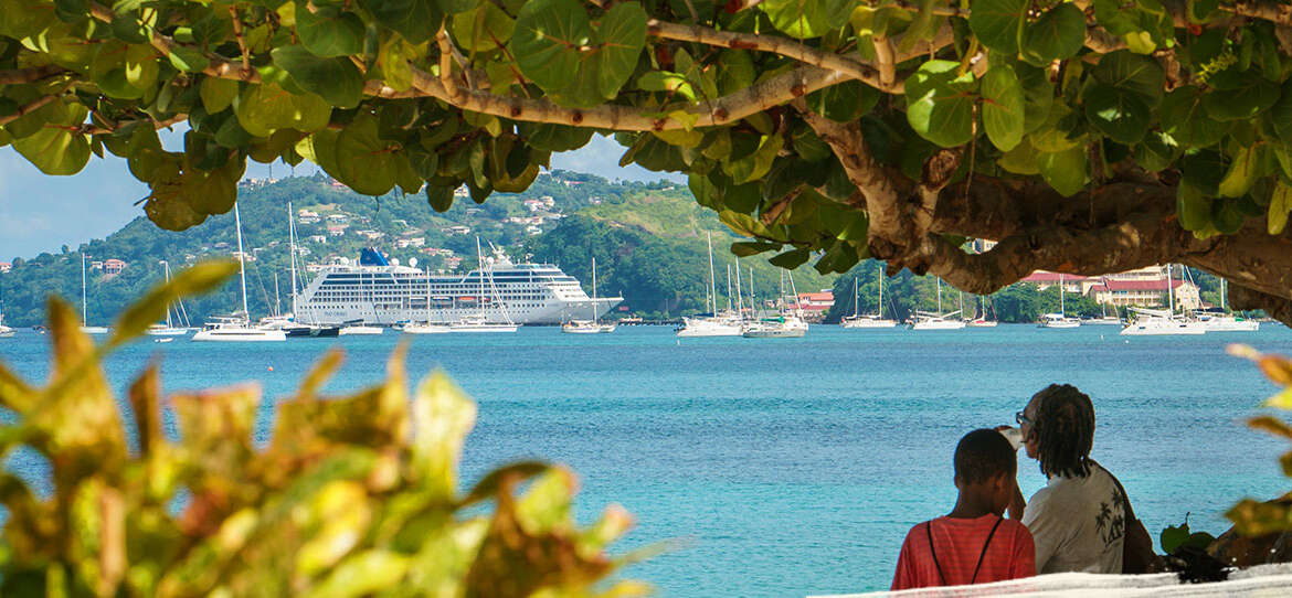
Cruising into Grenada and Carriacou is a delightful experience. Greeted by a picturesque harbour and a further welcome in the form of traditional dancing and drumming, you get an instant injection of spice island culture. We have compiled a few suggestions for you to make the most of your day.
The Grenada Ports Authority is principally responsible for the administration and operation of the Port of St. George’s. It also has jurisdiction over Prickly Bay, St. David’s Harbour and Grenville, on the main island of Grenada, as well Tyrrel Bay, on the neighbouring island of Carriacou.
PORT OF ST. GEORGE’S
St George’s lies in position 12°03’N, 61°45’W on the south-west side of the mainland. The port takes in that area of water enclosed within a line from Point Salines to Point Moliniere. The inner part of the harbour consists of two basins – the Carenage and the Lagoon – with access through a common entrance. From a westerly direction to north of Annas Shoal there is a well-marked channel north-east of harbour, with a minimum depth of 19.5 metres, that leads almost to quay. About 800 metres before quay, the channel turns north and there are shoals either side.
Vessels may anchor north-west of the harbour in position 12°3′.2N, 61°45′.8W in depths from 12.0 to 23.0 metres at LAT. Anchoring is prohibited within 200 metres of any beach without written permission. The Carenage or north basin is available as an anchorage for commercial vessels with depths from 9.1 to 20.1 metres. The Lagoon or south basin has depths from 4.9 to 8.2 metres and contains a yacht marina on its west side. The entrance channel from the Carenage to the Lagoon has a depth of 3.4 metres.
PRICKLY BAY
The Port of Lance aux Epines (Prickly Bay), located in position 12°00’N, 61°45.7’W on the south coast of the mainland, is a port of entry for yachts only. The port consists of the water north of a line from Prickly Point to True Blue Point (Mace Point). A reef extends the full length of the eastern shore, so yachts should proceed with caution. True Blue Point should be given a wide berth owing to shoaling just offshore.
Approach from south-west with caution. The Porpoises – a group of rocks located about half a mile south of Prickly Point – are sometimes awash and difficult to spot, being about 3 ft above sea level at low tide. Anchorage is permitted inside the bay in depths of 5.0 to 15.0 metres with good holding grounds in a mixture of sand and mud. Anchorage within 200 metres of the beach on the northern shore is prohibited. Spice Island Marine Service Co Ltd is a modern full-service marina with a 35-ton travel hoist.
PORT OF GRENVILLE
The Port of Grenville is defined by the water enclosed by a line from Telescope Point to Soubise Point to the nearest point on the mainland at Soubise. Grenville Bay, in position 12°7’N, 61°37’W, and St Andrew’s Bay, separated by Marquis Islet, should not be entered without local knowledge. Breaking seas across the entrance to Grenville Bay will be experienced during strong north-east winds. The port has a single pier with a depth alongside of 3.0 metres at its head. Vessels over 3.0 metres draught can anchor safely within the outer reefs, Pilotage is compulsory for all vessels over 150 grt. Pilots are based in St George’s.
TYRELL BAY
Located in position 12°27’N, 61°29.2’W, in the south-west corner of Carriacou, it includes all the water within Tyrrel Bay east of a line drawn on longitude 61°31’W. Vessels can anchor in 9.1 to 27.45 metres in the northern outer part of the bay. Anchoring is prohibited in the inner lagoon. There is a 90 metre long jetty at the northern end of the beach and a tanker terminal to the south of the jetty. Pilotage is compulsory for tankers over 100 grt, with at least 24 hours’ notice required.
ST. DAVID’S HARBOUR
Located on Grenada’s south coast, St David’s Harbour is defined as being north of a line from Little Bacolet Point (12°0,63’N, 61°40.96’W) to St David’s Point (12°0.78’N, 61°40.51’W) including all of the foreshore. St David’s Point has a distinctive rock at the peninsula forming the eastern side of the harbour entrance. The channel is marked by buoys and the harbour may be used only by yachts.
PORT OF HILLSBOROUGH
The Port of Hillsborough, on the west coast of Carriacou, takes in all the waters within a line from Craigston Point westward to the north side of Jack-a-Dan Island and then west to the north side of Mabouya Island and then south to Cistern Point and then back along the foreshore to the starting point. Hillsborough Bay (12°N, 61°28’W) is entered between Jack-a-Dan and Sandy Islet. A town stands at the head of the bay.


