Culture & Events in The Marshall Islands
GEOLOGICAL HISTORY
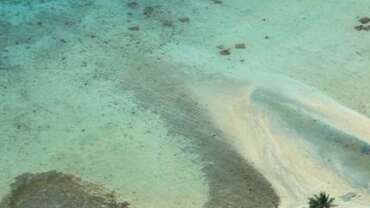
The Marshall Islands first emerged 70 million years ago when volcanic cores erupted at presently extinct hotspots south of the equator. Around 40 million years ago, while the Pacific plate continued to move in a northwesterly direction, the volcanoes began to subside. The islands were initially high, volcanic islands, but over the course of the ensuing 40 million years, they slowly sank back into the ocean from which they came, propelled by their own weight. Microscopic organisms called polyps, which thrive in warm waters with high salinity, salvaged the remaining rim of what was once a volcano to the extent that, with botanical seeds transported by birds and ocean currents, 3,000 years ago small islets had taken form on the reefs, capable of sustaining life. These islets formed circular rings encircling sheltered lagoons, namely our beautiful atolls we today can share with visitors.
PACIFIC COLONIZATION
The predominant theory on the colonization of the Pacific postulates that the initial settlers moved out of Southeast Asia, notably Southeast China and Formosa approximately 5,000 years ago. Over hundreds of years, and with successive advancements in maritime and agricultural technology, migration progressed southeastward along the northern coast of what is now New Guinea, then southeast into what are now the Melanesian island groups of Solomon Islands, Vanuatu, and New Caledonia, and sometime between 2,000 to 3,000 years ago, into the Central Pacific: Fiji, Tonga, Samoa and probably Eastern Micronesia. According to linguists, the migrants who first moved out of Southeast Asia spoke in the Austronesian language family and today, nearly all languages in the Pacific are categorized as Austronesian. Over the last several decades, successive developments in different fields such as archaeology, linguistics and biology have shaped, strengthened and won general consensus on this theory.
UNIQUE CULTURAL SKILLS AND TECHNOLOGIES
Over the last 2,000 or so years, Marshallese have developed, refined and perfected a number of unique skills and technologies, all of which illustrated their keen adaptation to the atoll and oceanic environment.
Fishing technology, for instance, developed into one with very high specialization. The wide range of fishing environments coupled with the great variation in fish species led to a diverse and highly specialized range of fishing techniques. Few other cultures in the world have developed as many fishing techniques and styles as the Marshallese.
Marshallese canoes, or wa, which range from small rowing canoes to massive high-speed voyaging canoes have amazed Westerners from Otto Von Kotzebue, who visited the Marshalls in the early 1800s, to modern day world-class sailing enthusiasts. Marshallese canoes are recognized and revered throughout the Pacific for their advanced technical refinements, including the asymmetric hull, the lee platform, and the pivoting midship mast.
Traditional Marshallese navigational skills were equally sophisticated. When the initial settlers of the Marshalls arrived, they were already equipped with complex navigational skills- otherwise, they could not have found their way to these low-lying islands. As time progressed, these skills were only sharpened. Ultimately, Marshallese learned to literally read nature’s faint and subtle signs. Stars, clouds, waves, currents, winds, birds, and even the color of the ocean, bore recognizable clues which were easily read by trained navigators. These advancements in both maritime knowledge and canoe design allowed Marshallese to commonly sail as far as Enenkio (Wake Island) to the north, Pohnpei to the west and Kiribati to the south.
While all islanders in the Pacific possessed some sort of navigational technology, Marshallese developed perhaps the most advanced methods of teaching this skill. Young apprentices spent much of their training feeling the waves beneath them as they lied on their backs in the ocean, in the process gaining the skill of seeing the island causing that wave pattern beneath them. In addition, navigational stick charts of various size and shape were devised to depicted complex wave and wind patterns in relation to individual islands, atolls and atoll groups. With these charts, elders were able to more easily explain and teach complex navigational concepts such as wave refraction and swell pattern identification.


