Destinations of Kyrgyzstan by Regions
BATKEN
Batken is a small town in southwestern Kyrgyzstan, on the southern fringe of the Fergana Valley. It is the capital of Batken Region. Its area is 205 square kilometres.
SARKENT NATIONAL NATURE RESERVE
The Sarkent National Nature Reserve is located in the Leilek district of Bakten province. The park covers an area of 40,000 hectares. It was established to preserve the biological diversity of natural systems and is home to animals listed in the Red Book, such as brown bears, snow leopards, lynxes, golden eagles, saker falcons, and Himalayan vultures. The landscape is characterized by juniper forests. The reserve contains five different lakes.
AI KÖL LAKE
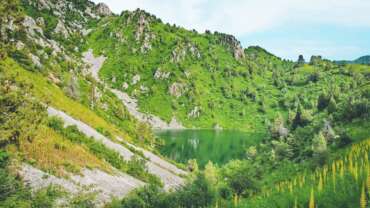
The Ai Köl lake is located on the northern slope of the Turkestan range, about 3000 meters above sea level. It is a small lake surrounded by large cliffs. One can observe its beauty only from afar. The lake is fed by two brooks.
AIGUL TASH MOUNTAIN
The Aigul Tash mountain is located at the entrance of the Kara Bulak village. It is home to an amazingly beautiful flower which red and yellow petals endemic to the area, called aigul, that blooms in April. According to legend, a maiden named Aigul was unable to withstand the news that the man that she loved had died in battle, and threw herself off the cliff of this very mountain. When spring came, wonderful flowers started growing in the places where the maiden’s drops of blood had fallen. People named the flowers Aigul and the mountain Aigul-Tash, after the maiden. The flower is listed in the Red Book.
KARAVSHIN GORGE
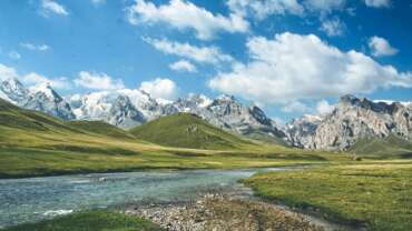
The Karavshin Gorge is situated in the Turkestan Range. This marvelous piece of nature contains rocky mountains, fast flowing rivers, clean spring waters, and green meadows. It much resembles the South American Steppes, giving itself the nickname “The Asian Patagonia,” as deemed by lovers of the outdoors.
BISHKEK
Bishkek, the capital of Kyrgyzstan, borders Central Asia’s Tian Shan range. It’s a gateway to the Kyrgyz Ala-Too mountains and Ala Archa National Park, with glaciers and wildlife trails. The city’s arts scene encompasses the monumental State Museum of Fine Arts and the colonnaded Opera and Ballet Theater. The vast, central Ala-Too Square features the Manas monument, honoring the hero of the Kyrgyz Epic of Manas.
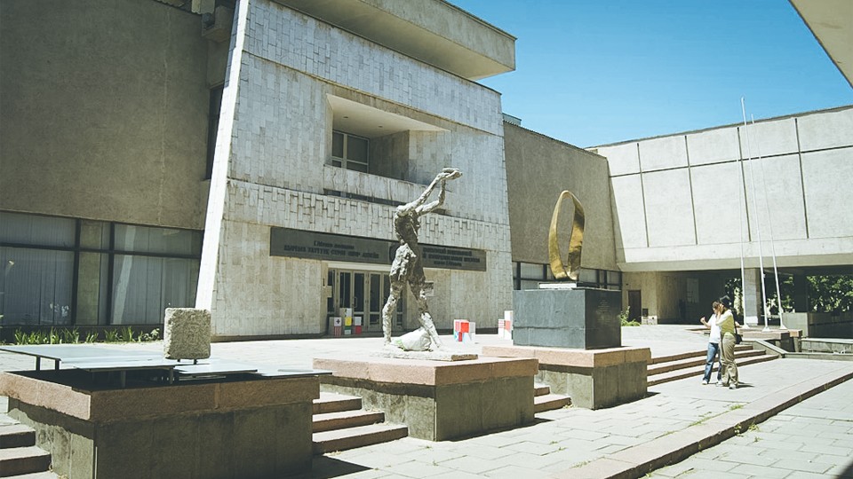
GAPAR AITIEV ARTS MUSEUM
The museum was founded on January 1, 1935. Seventy-two works of Russian artists received from the State Tretyakov Gallery and the Hermitage make up the basis of the museum. The museum includes works by painters and sculptors of both the Soviet Era and modern Kyrgyzstan, as well as items of traditional Kyrgyz decorative and applied arts – which allow one to see and understand the development stages of the Kyrgyz culture and art – and that of the formation of national school of professional fine arts. Among the artists of famous works presented in the museum, it is worth mentioning G. Aitiev, S. Chuikov, S. Akylbekov, L. Ilyina, T. Sadykov, and T. Herzen. Today, there are about 18,000 artworks in the museum, and it is regularly updated with the works of Kyrgyz artists.
ALA-TOO SQUARE
The Ala-Too Square is one of the main attractions of the country and a favorite place for all city dwellers. Construction of the entire complex was completed in the 1970’s. This spacious area is a venue for celebrations, festivals, and rallies. Each and every of the monuments erected in memory of the Kyrgyz people’s heroes (Manas Magnanimous, the great writer Chyngyz Aitmatov, wise and brave Kurmandjan Datka and the heroes who fell in Aksy, and April events) decorate the square. A 45-meter flagpole flaunts in the heart of the square. The Government House, State Historical Museum, Oak Park, Monument of Friendship of Peoples, Open Air Sculptures Museum, and many other cultural and recreational facilities are located on the perimeter of the square.
ATA BEYIT MEMORIAL COMPLEX
The Ata Beyit Memorial Complex is located 30 km from Bishkek in the village of Chong-Tash. The complex was built on the burial site of the bodies of 137 people of 19 nationalities who were executed without any trial during the Stalinist repression. Their bodies were thrown into the brick kiln. There were eminent statesmen and public figures among these people who had laid the foundation of Kyrgyz statehood back in the 1920’s and 1930’s, such as Zhusup Abdrakhmanov, Bayaly Isakeev, Törökul Aitmatov (Chyngyz Aitmatov’s father), Hassan Zheenbaev, Erkinbek Esenamanov, Murad Salikhov, Sultankul Shamurzin, Imanaaly Aidarbekov and Kasym Tynystanov. Interestingly, the location was kept secret, and only in the early 1990’s, based on Bübüra Kydyralieva’s story, did the public learn about the place. Extensive work has been done to identify each of the bodies and the remains of the victims had been properly buried on August 30, 1991.
CHUI
Chuy Region or Chui Region is the northernmost region of the Kyrgyz Republic. It is bounded on the north by Kazakhstan, and clockwise, Issyk Kul Region, Naryn Region, Jalal-Abad Region, and Talas Region. Its administrative center is Bishkek, but from 2003 to May 2006, it was Tokmok.
KORONA PEAK
The Korona (‘crown’) Peak is one of the most beautiful peaks of the Kyrgyz Ala-Too ranges, popular among climbers from around the world. The peak is located at the top of the Ak-Sai glacier in the Ala-Archa gorge. The name of this 4860 meter high peak is no coincidence; six mountain towers resemble a majestic crown when viewed from a distance. The towers are so steep that the snow does not manage to stay on their tops and walls, which adds to the splendor of the landscape.
SUUSAMYR VALLEY
Suusamyr is one of the largest alpine valleys, located at an altitude of 2000-3200 meters between the Kyrgyz Ala Too, Suusamyr Too, and Djumgal Too ranges. It stretches more than 150 km from the west, starting from the Ala-Bel Pass, to the east, up to the Kokomeren River. The entire surface of the valley is covered with thick lush green meadows. Being the birthplace of Kodjomkul, the greatest kyrgyz wrestler of the 20th century, Suusamyr is one of those places in Kyrgyzstan which come to mind when one thinks of jailoo, koumiss, paragliding, skiing, and heli-skiing.
ZIL SKI RESORT
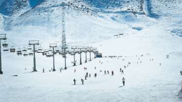
The ZiL Ski Resort is located 35 km from Bishkek in a beautiful scenic location, at an altitude of 1850 above sea level. The resort is one of the top places for skiing for both Kyrgyz and foreign visitors. There are five different ski lifts operating in the resort. There are also three cafes, a hotel complex with nineteen rooms with well-developed infrastructure, ski equipment rental, and first-aid post. A glacier called Kentor is located 5 km from the ski resort, sitting at an altitude of 3500 meters. If a ski lift were to be built on this glacier, it would be possible to ski here all year round, as opposed to only December through March.
TOO-ASHU PASS
Too-Ashu is a high mountain pass 135 km from Bishkek, on the main highway, linking the northern and southern regions of Kyrgyzstan. The altitude of the pass is 3400 meters above sea level. The road is serpentine and views from it are truly breathtaking. The popular Too-Ashu Ski Resort is situated on the southern slope. The Suusamyr Valley is located just behind the pass.
ALA-ARCHA NATIONAL PARK
Located at an altitude of 1500-4895 meters above sea level, 41 km from Bishkek, and occupying an area of approximately 20 hectares, the Ala-Archa National Park includes all landscape and climatic zones. A river with the same name flows through the gorge. The beautiful landscape and richness of flora and fauna in the park allows it to be used for hiking, recreation, and leisure all year round.
KEL-TOR GORGE
The Kel-Tor Gorge is an offshoot of the Kegety Gorge, with a river of the same name and amazing landscape. It is located 90 km from Bishkek. At the end of the gorge, a small lake characterized by its turquoise color, is the main attraction. The gorge is rich in spruce forests, herbs (sage, St. John’s wort, thyme) and varieties of berries (mountain ash, honeysuckle, wild rose, barberry).
KEGETY GORGE
The Kegety Gorge is located 75 km from the city of Bishkek on the northern slope of Kyrgyz Ala-Too, and has rich flora. Tall grasslands, barberry, rowan, wild rose, and fir forests largely contribute to the beauty of the gorge. The Kegety river, which flows through the gorge, has many tributaries. The largest of them is the the Kel-Tor river (the right tributary) which flows down through a smaller gorge with beautiful landscape. The main source of the Kel-Tor river flows through moraine passes under the ground and breaks out roaring at a certain point in a forested area. Natural and climatic features of the Kegety Gorge are favorable for hiking and trekking, as well as picnics.
ISSYK-ATA GORGE
The Issyk-Ata gorge is located on the northern slopes of the Kyrgyz Ala-Too Range, 77 km east of the city of Bishkek. The gorge is well known not only for its gorgeous climatic conditions, but also for its excellent balneotherapical resources. The Issyk-Ata Resort was built in the middle of the gorge, in 1928, on the basis of the more than fifty thermal and mineral springs found here. Healing properties of these waters have been known since ancient times, as evidenced by the picture of Buddha-the- Healer carved on a huge stone dating back to 8th century. Mountain slopes above 2800 meters are covered with juniper forests. Surrounded by high slopes and cliffs, the gorge has spectacular landscape.
CHONG-KEMIN VALLEY
There is an amazingly beautiful valley called Chong-Kemin between Kungey Ala-Too and Ile Alatau ranges that stretches more than 100 km from east to west. The river in the valley is also called Chong Kemin and it flows into the Chu river where the Boom Gorge starts. It is a well known destination among white water rafting and kayaking enthusiasts. The valley covers the territory of the Chong-Kemin State Nature Park. The park is the habitat of animals such as alpine ibex, argalis, martens, ermines, rock partridges, snow leopards, deer, Turkestan lynxex, golden eagles, saker falcons, and bearded vultures. In the park, there is also the mausoleum of Shabdan Baatyr, a Kyrgyz historic figure who took active role in accession of Kyrgyz people to the Russian Empire in the 19th century.
BOOM GORGE
The Boom Gorge is located 112 km from Bishkek and is a natural gateway connecting the Issyk-Kul basin with Chui valley. The length of the gorge is 22 km. The sector of the Chu river in the Boom gorge has long been a very attractive destination for enthusiasts of rafting and kayaking.
ALAMEDIN GORGE
The well known Alamedin Gorge is located 30 km from Bishkek, at an altitude of 1800-2000 meters above sea level. Juniper, birch, black currant, common cockle, rose hips, and sea buckthorn are just some examples of the area’s rich flora. The river that flows through the gorge is also called Alamedin. Going farrther up through the gorge, one can see steep cliffs that look like ruins of ancient fortresses. There are also the peaks Aitmatov (4650 meters) and Kyrgyzstan (4860 meters) which always attract tourists’ attention. The Alamedin Gorge is famous for its hot mineralized springs, of which there is a small spa resort based on.
CHUNKURCHAK SKI RESORT
The Chunkurchak Ski Resort is a young and developing ski resort, located 30 km from Bishkek, in the picturesque Chunkurchak Valley. The resort provides proximity to the capital, compact arrangement of service facilities, and comfortable pistes for amateur skiers, making it an ideal destination for family holidays. There are four different chairlifts. Guests can benefit from facilities such as the cafe, sports equipment rental, medical center, and children’s playground, all of which are available on the premises of the resort. Ski season : December – March.
BURANA TOWER
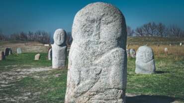
Being once a minaret of a mosque, Burana Tower is located near Tokmok in the territory of Balasagun, which was a medieval capital (9th – 14th centuries) of Karakhanid Khanate and home to famous medieval poet Yusuf Balasaguni, author of the poem Kudatgu Bilig (Beneficial Knowledge). The tower was built in the first half of the 11th century. With time, the mosque got completely destroyed, and the minaret was partially ruined by an earthquake in the 15th century. Today, the tower stands at about 25 meters, although it was originally 45 meters tall. An open-air archaeological and architectural museum was created at the basis of the legendary Balasagun.
KONORCHEK CANYONS
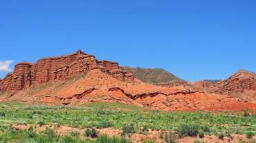
The Konorchek сanyons are located on the eastern part of Kyrgyz Ala-Too range. These are magnificent monuments of nature, formed over several million years at the hands of natural forces such as the sun, wind, and waters. These huge clay lumps take on forms that resemble ancient castles, churches, modern buildings, and animals. The altitudes of some canyons reach 300 meters. An extinct volcano called Segizhan Shokny (approximately 2.5-3 million years old) is another attraction that compliments the canyons.
ISSYK KUL
Issyk-Kul is an endorheic lake in the Northern Tian Shan mountains in Eastern Kyrgyzstan. It is the seventh deepest lake in the world, the tenth largest lake in the world by volume and the second largest saline lake after the Caspian Sea.
ALTYN ARASHAN THERMAL RESORT
This small thermal resort is situated in the picturesque Altyn-Arashan gorge, 2600 meters above sea level, with spruce forest and green meadows on the banks of the Arashan River. It was built on the basis of hot springs with high mineral content and radioactivity. The springs contain radon and are used in the treatment of diseases relating to nervous, cardiovascular, endocrine, and the musculoskeletal systems.
RUH ORDO CULTURAL CENTER
The Cultural Center, named after famous Kyrgyz writer Chyngyz Aitmatov, was founded in 2002 in Cholpon Ata, right on the shore of Issyk Kul Lake in the open air. Ruh Ordo combines elements of various cultures and religions. Sculptures and portraits of famous people who left their mark in the history of mankind can be found here. One may also visit the Buddhist, Catholic, Orthodox, Muslim and Jewish churches that sit next to each other, symbolizing the unity of faith of all people on Earth. Ruh Ordo, which means ‘spiritual center’ in Kyrgyz, is a special place where the atmosphere of peace prevails, which allows one to move away from the daily hustle and bustle and make a short trip into the world of beauty, into the spiritual world.
TUZ-KÖL (KARA-KÖL)
Tuz-Köl (also named Kara Köl, meaning ‘dead lake’) is the saltiest lake in Kyrgyzstan with a perimeter of 1500 meters and depth of 11 meters. It is located on the southern shore of Issyk Kul Lake, near the village of Kara-Koo, 1609 meters above sea level. This lake is often compared to the Dead Sea in Israel. The water in the lake is so dense that swimming in it is like floating. According to scientific data, the amount of salt in the lake is 132 grams per liter. The high concentration of salt helps cure many diseases, such as psoriasis and other dermatological, gynecological, and musculoskeletal diseases. The silt mud along the coast formed as a result of microorganism activities has long been used for therapeutic and cosmetic purposes.
ALAKUL LAKE
The Alakul Lake is located amid the rocky ridges of the Terskey Ala Too range, at an altitude of 3532 meters. Although the surface area of this glacial lake is just under 1.5 km2, the waters reach a depth of more than 70 meters. This is a motley lake, its colors entirely contingent on the weather.
JETI OGUZ GORGE
The picturesque Jeti Oguz gorge is located 28 km southwest of the town of Karakol. Its name in Kyrgyz means ‘seven bulls,’ referring to the seven large red-brown cliffs, reminiscent of seven fierce bulls. The Jaralangan Jurok (Broken Heart Rock), located at the entrance to the gorge, is especially aesthetically romantic. The Jeti Oguz Health Resort, located in the gorge, is well known for its geothermal springs. Another must-visit destination is Kyzdyn Koz Jashy (Maidens’ Tears Waterfall), standing at 2500 meters high. Brooks running down along a 40 meter steep rock wall and forming hundreds of thousands of small streams and drops, truly captivating to the eye, resembles tears, giving the waterfall its name.
BARSKOON GORGE
The Barskoon Gorge is located on the southern shore of the Issyk Kul Lake, above the Barskoon village, 90 km from Karakol. A river with the same name runs through it. The length of the gorge is about 10 km. It is famous for its beautiful waterfalls with unique names, such as ‘Tears of the Leopard,’ ‘White Beard,’ ‘Splashes of Champagne,’ and ‘The Bowl of Manas’. In 1965, the first astronaut Yuri Gagarin visited this place and enjoyed its beautiful landscape. Two monuments were later installed in his memory. The road that leads to the well-known Kumtor gold mine passes through the gorge. This road was once one of the branches of the Great Silk Road, which passed through the Barskhoon city, a thriving medieval city in the 8th -13th centuries on the site of today’s Barskoon village.
ISSYK-KUL LAKE
Issyk-Kul is the largest lake in Kyrgyzstan, surrounded on two sides by the Terskey Alatoo and Kungey Ala-Too ranges. It is widely believed that the name Issyk Kul in Kyrgyz means ‘hot lake,’ because the water in the lake never freezes. The name of the lake also bears religious significance. The adjective ‘issyk’ is phonetically modified form of the ancient Turkic word ‘ydyk’ which means ‘sacred.’ This unique lake was considered sacred among indigenous people. Located at an altitude of 1609 meters, the lake covers an area of 6236 km2 and has an average depth of 300 meters (although it can reach depths of 668 meters in some areas). It is one of the largest and deepest alpine lakes in the world. The coast is famous for its exceptional landscape and particular maritime climate.It is also the largest health resort zone in Central Asia, with numerous health resorts, hotels, and private guest houses, making it a top destination.
MANJYLY ATA VALLEY
The Manjyly-Ata Valley, also called the Valley of Sacred Springs, is located on the southern shore of Issyk Kul Lake between the Kaji-Sai and Tong villages. The waters in the springs, which are located among numerous clay hills, are considered sacred and curative, each having a different taste. According to legend, the area is the mazar (burial place) of a once famous old healer whose name was Manjyly. After his death, people kept visiting his mazar hoping to find cures for their ailments, thus making it an object of pilgrimage.
SARYCHAT-EERTASH STATE RESERVE
The Sarychat-Eеrtash State Reserve is situated in the Jeti-Oguz district of the Issyk-Kul province, covering the basins of the Sarychat and Bordu rivers on the southern slope of Teskei Ala-Too. The territory of the reserve has an area of 72080 hectares. The primary task of the reserve is preservation of the alpine ecosystems and endangered species such as mountain sheep, alpine ibex, snow leopards, etc.
HOLY TRINITY ORTHODOX CHURCH
The Holy Trinity Orthodox Church is located in the center of the city of Karakol. It was built in 1894-1895 on the site of an older church, which was destroyed by an earthquake. The facade of this four-column church is decorated with carvings, a bell tower at the top, and a gilded dome on the roof, characterizing a traditional Orthodox church. The church is home to the miraculous icon of Our Lady of Tikhvin.
FAIRY TALE CANYON
The Fairy Tale Canyon is located on the southern shore of Issyk-Kul Lake, 4 km from Tosor village. This is a true natural wonder. Water, wind, and sun have produced whimsical, fabulous shapes here. While some resemble mythical creatures (dragon ridge), the others look like other ordinary animals (camels, hippos, and elephants), while others portray amazing intricate structures such as castles, towers, and even China’s Great Wall. Due to particular nature of the soil, it is recommended to visit the canyon in dry weather.
AK-SUU GORGE
The Ak-Suu Gorge (also called the Semenov Gorge) is located 40 km from Cholpon-Ata. The length of the gorge is about 30 km. The river called Kichi Ak-Suu runs through the bottom of the gorge. The slopes of the gorge are covered with Tien Shan fir trees and fragrant mountain herbs. Waterfalls at the source of the Kichi Ak-Suu river, the Kyrchyn mountain pasture, where the cultural part of the I World Nomad Games took place, and the Süttüü-Bulak lake formed as a result of an earthquake, are among the main destinations of the Ak-Suu Gorge.
CHONG AK SUU GORGE
The Chong Ak Suu Gorge (also called the Grigoriev Gorge) is located on the northern shore of the Issyk-Kul Lake, on the slopes of Kungei Ala-Too, covered with lush green grass and pine forests, 60 kilometers from the city of Cholpon-Ata. The gorge is one of the most popular tourist destinations of Issyk-Kul. Three beautiful moraine lakes are among the main attractions of the gorge.
ÖRNÖK PETROGLYPHS
The outskirts of the Örnök village, in the Issyk-Kul province, host priceless historical monuments, such as petroglyphs and burial mounds. More than 2000 stone blocks have engraved images of wild and domestic animals and life-scenes (such as hunting, war, rituals, etc.) of ancient inhabitants of these lands, representing different time periods – Skythian, Usun, and Turkic.
DUNGAN MOSQUE
The Dungan Mosque was built in 1910-1912. This particular style of architecture was created by the best masters, headed by architect Zhou Si, who Haji Ibrahim specially invited from Beijing. The local people also took part in the construction of the mosque. This one-storey wooden building was made without a single nail. The corners of the roof were decorated with dragon figurines; the walls with images of plants and mythological animals which, according to popular belief, bring abundance and ward off evil spirits, respectively.
JALAL ABAD
Jalal-Abad is the administrative and economic centre of Jalal-Abad Region in southwestern Kyrgyzstan. Its area is 88 square kilometres.
ARSLANBOB WALNUT FORESTS
The walnut forests of Arslanbob are a rare masterpiece of nature with their beauty and diversity of plant species. This picturesque area is located 50 kilometers north of the city of Jalal Abad. The territory, with an overall area of 608,500 hectares is home to 130 different tree and shrub species. The most common plants are walnut trees, providing 200-400 kg of fruit per year. A common legend says that Alexander the Great came to these lands in 329 BC and was so delighted by the taste of the nuts, he brought them back home and cultivated them, later spreading them all throughout Greece.
SARY CHELEK LAKE
Sary Chelek lake is located 500 km from Bishkek and 300 km from Osh, in the territory of the Sary Chelek State Biosphere Reserve. The lake lies on the boundary of At-Oinok and Chatkal ranges, at an altitude of 1940 meters. The lake covers an area of 507 hectares, has a length of 7.5 km, and a depth of 234 meters. It is the second and third deepest lake in Kyrgyzstan and Central Asia, respectively. The coastline is covered with dense forests and rocky places in some areas. Sary Chelek is fed by several mountain rivers. The water temperature in summer does not exceed 19 °C and in winter ranges from 0 °C to 4 °C. Sary Chelek in Kyrgyz means ‘yellow barrel.’ According to legend, there was once an old beekeeper who, one spring, decided to place hives on the shores of an unusually beautiful lake. When the time for harvest had come, the beekeeper was so mesmerized by the golden color of honey, he named the lake Yellow Barrels referring to the barrels full of honey on the shore. Additionally, there is also another explanation to the name of the lake. As autumn rolls around, the golden color of the trees on the coastline reflected in the water form a fabulous whole golden landscape. The Sary Chelek State Biosphere Reserve (area 23,8 ha) is included in UNESCO’s international network of nature reserves. It was established to preserve the flora and fauna of the walnut forests and alpine landscapes.
SAIMALUU TASH STATE NATURAL PARK
Saimaluu Tash State Natural Park is situated in the Toguz Toro district of the Jalal Abad province, along the Kugart River. It sits on a total area of 32050 hectares. 16 species of mammals, 45 species of birds, and 1500 species of plants are registered in the park. Saimaluu Tash means ‘patterned stone’ in Kyrgyz. Rock carvings are the main cultural and historical value of the park. The area has the largest accumulation of petroglyphs (about 90,000 stones) in Central Asia.
MAUSOLEUM OF SHAH FAZIL
The Mausoleum of Shah Fazil is a part of the Shah Fazil Historical and Architectural Complex. The complex is located in the Gulistan village of Ala Buka district. The mausoleum is the burial place of Mahmud ibn Nasir (nicknamed Shah Fazil, fair shah), who came from the Kara-Khanid dynasty that ruled in the 10th-12th centuries. The height of this pyramidal structure is 15.5 meters. The structure consists of a step drum and tall dome resting on it. The interior of the building is decorated with ganch-stucco carvings of bright colors.
NARYN
Naryn was established as a fortress on the caravan route in 1868. It is situated on both banks of the Naryn River (one of the main head waters of the Syr Darya), which cuts a picturesque gorge through the town.
NARYN STATE RESERVE
The Naryn State Reserve is located in the eastern part of the Naryn province. Its territory begins at the source of the Naryn River and covers a hillside forest of the Naryn-Too mountain range. The total area of the reserve is about 24,969 hectares, aside from the nearby 53,388 hectares of land that is also under environmental protection. The primary task of the reserve is protection and conservation of region’s flora and fauna. It is home to 1870 plant and 50 animal species. The most commonly found plants are spruce, rowan, willow, juniper, wild rose, and currants. Deer, mountain goats, mountain sheep, bears, wolves, snow leopards, lynxes, and martens are just some of the animals protected by the reserve.
CHATYR-KUL LAKE
The Chatyr-Kul Lake is located between the At-Bashy and Torugart-Too ranges, and is situated at an altitude of 3530 meters above sea level. The dimensions of the lake are as follows: length – 23 km, width – 11 km, surface area – 170.62 km2, depth – 20 meters. In the winter, the water surface is covered with about a meter thick layer of ice. In the spring, the lake is filled with streams of mountain rivers, which flow down from the glaciers. The southeastern shore of the lake is swampy, while the northern shore is rocky. Some of the animal species that live in the surrounding area include wild ducks, mountain geese, snow leopards, marmots, and mountain goats. The lake is a part of the Karatal-Japyryk State Reserve.
SONG-KUL LAKE
The Song Kul Lake is located in the southwestern part of the Naryn province, within a basin between the Song Kul Too and Moldo Too mountain ridges, at an altitude of 3016 meters. It is the second largest lake, after Issyk-Kul, with a surface area of 278 km2 and a maximum depth of 14 meters. The lake is fed by several mountain rivers. The spacious meadows around the lake have been used as summer pastures by nomadic shepherds since the ancient times.
AK-SAI VALLEY
Ak-Sai is a broad alpine valley located in the border area between At Bashy and Torugart, situated at an altitude of 2900-3800 meters, in inner Tien Shan. Ak-Sai is surrounded by mountains, 3900-5000 meters high, covered with glaciers. Sub-alpine semi-deserts (up to 3100-3600 meters), alpine meadows, tundra in some areas (3600-3900 meters), and nival-glacial zones (above 3900 meters) are typical to the valley. The vegetation consists of short, thick grass that covers numerous swamps and lakes at moderate altitudes. Marco Polo sheep and alpine ibex are famous inhabitants of the valley.
TASH RABAT CARAVANSERAI
This well preserved historical monument is located 110 km from the town of Naryn, in the valley of Kara Koyun, stationed at an altitude of 3200 meters. It was built approximately in the 15th century, and was home to merchants and travelers, and linked the Fergana and Chui valleys to Kashgar.
KEL-SUU LAKE
The Kel-Suu Lake is located in the Naryn province, in the Kakshaal Too range of Inner Tien Shan, situated at an altitude of 3400 meters above sea level. It is quite close to the Chinese border. Surrounded by high rocky cliffs, it was formed as a result of large rockfall that blocked the narrow channel of the river. Kel-Suu stretches for more than 12 km and is 2 km wide. The depth varies, depending on the season of the year – reaching the maximum depth towards the end of summer as a result of the melting snow and ice in the mountains. The water in the lake is fresh and exhibits a greenish color. One can experience the lake in its full beauty by going for a ride on a motorboat.
ORTO TOKOY RESERVOIR
The first reservoir built in Kyrgyzstan in 1956, Orto Tokoy, is located in Kochkor district in the Naryn province on the Chu River, at an altitude of 1700 meters. The length of the reservoir is 18 km, width 3-5 km, depth 47 meters, total surface area about 24 km2 and volume more than 4.7 billion m3 . The reservoir was built with the purpose of melioration of agricultural lands in Kyrgyzstan (86,000 hectares) and Kazakhstan (34,000 hectares).
EKI NARYN VALLEY
The Eki Naryn Valley is located 45 km from the town of Naryn, sitting at an altitude of 2000 meters. Here, large and small tributaries of the Naryn River merge together, giving it the name that means ‘two Naryns.’ This area is characterized by meadows, pastures, and pine forests. Located within the territory of the Naryn State Reserve, it is also the habitat of bears, wild boars, mountain goats, and snow leopards.
OSH
Osh is the second largest city in Kyrgyzstan, located in the Fergana Valley in the south of the country and often referred to as the “capital of the south”. It is the oldest city in the country, and has served as the administrative center of Osh Region since 1939.
ALAI VALLEY
Highland Alai Valley is located in the southernmost area of Kyrgyzstan. This tectonic depression is bounded on the north and south by Alai and Trans-Alai ranges, respectively. It is located 2240-3536 meters above sea level, the average height is 3000 meters. The valley stretches 174 km from west to east. The width varies between 3 to 40 km. The area is 8400 km2 . Despite its cold and dry climate, the valley is rich in succulent summer pastures. It is home to various wildlife, including rock partridge, ular, foxes, Alai red marmots, bears and mountain goats.
ABSHYR ATA WATERFALL
The Abshyr Ata waterfall is located 70 km from the city of Osh, in the Abshyr Sai valley (sitting 1500-2500 meters above sea level). One has to walk about 3 km along the river and through the gorge to see this unique creation of nature. A powerful water flow breaks out from a hole on a steep cliff (1.5-2 meters in diameter) at a height of 12-15 meters. The low-mineralized water is believed to have healing properties.
KYRGYZ ATA NATIONAL PARK
Kyrgyz Ata National Park is 40 km from the city of Osh, on the northern slope of the Alai Range. Its territory is located at medium altitudes. Juniper forests are well-preserved in the park. The park has an area of 11172 hectares. It was created to preserve the flora and fauna of the Pamir-Alai mountain system. The territory of the park is suitable for outdoor activities.
UZGEN (ÖZGÖN) MINARET
The Uzgen minaret is located in the town of Uzgen, which became the capital of the Karakhanid Khanate in the 12th century. The minaret is part of The Uzgen Historical and Architectural Complex dating back to 11th-12th centuries. Due to strong earthquakes, the top of the minaret has been destroyed and now sits at a height of 27.5 meters, however the structure of the minaret suggests that it originally stood about 45 meters tall. The walls of the building are made of fired brick and are decorated with patterns. The purpose of the minaret was to call the people to commit the namaz (obligatory prayer of muslims) as well as serve as a watchtower.
SULAIMAN TOO
The Sulaiman Too mountain is located in the center of Osh city. It is the first UNESCO World Heritage Site listed from Kyrgyzstan. Some historical and theological works, written sources, and ancient manuscripts mention that 366 of the 124 thousand prophets sent down by God in human history had visited this mountain. The mountain has has been considered a sacred place as evidenced by the paintings in the caves on the slopes of the mountain. Sulaiman Too is a historical and architectural complex at the top and on the slopes of the mountain, where many historical monuments of different eras – such as caves with ancient petroglyphs, the Takht-i Suleiman Mosque, Ravat Abdulla Mosque, the Asaf ibn Burhiya Mausoleum, and the historical museum with a rich collection of archaeological, ethnographic, and zoological exhibits – can be found. Almost every one of these places is a unique ritual object, surrounded by a veil of mystery and legend.
TALAS
Talas is a town in northwestern Kyrgyzstan, located in the Talas River valley between two mountain ranges. Its area is 13 square kilometres. It is the administrative headquarters of Talas Region. The town was founded by East Slavic settlers in 1877.
MANAS PEAK
The Manas Peak is the highest point of the Talas Ala-Too range located in its western part, reaching 4482 meters. Its slopes are so steep that no snow and ice ever cling to the mountainsides. Named after the great Kyrgyz hero Manas, this peak is the symbol of independence. Climbing to its top requires considerably strong skills and enormous efforts due to the steepness of the slopes.
BESH TASH NATIONAL PARK
Besh Tash National Park is 13 km from Talas and located on both sides of the Besh Tash river. The park, with an overall area of 32411 hectares, is home to rare plant and animal species included in the Red Book of the Kyrgyz Republic, such as argali, Turkestan lynx, snow leopards, golden eagles, Himalayan vultures, and saker falcons. There is a high altitude lake (2997 meters high, 28 meters deep) with the same name. Osman, marinka, and trout are some of the different fish that can be found in the lake, along with the rainbow trout found in the Besh Tash river.
KIROV RESERVOIR
The Kirov Reservoir is located in the Chon-Kapka gorge, in the Talas province. It covers an area of 39 sq. km, and reaches depths of up to seven meters. The reservoir was built for the purpose of irrigation for lands in Kyrgyzstan and Kazakhstan. With a picturesque scenery, the coastal areas are ideal for fishing as well as other recreational activities.
GUMBEZ OF MANAS
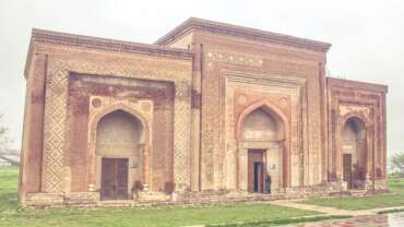
The Gumbez (Mausoleum) of Manas, a medieval architectural monument, is located in Kenkol valley, 22 km north-east of Talas. Although well known among people and in scientific literature as the Mausoleum of Manas, the inscription on the wall reads that the tomb belongs to the daughter of one of the rulers of the Chagatai Khanate. There is a famous legend saying that Kanykei, Manas’s wife, ordered masters from Bukhara and Samarkand to build this monument in memory of her deceased husband and that the girl’s name on the tomb was inscribed specially in order to distract the attention of the enemies. The walls of this building constructed of brick are decorated with Kyrgyz patterns and Arabic inscriptions. Today, it is surrounded by an architectural complex called Manas Ordo.


