Experiences in Reunion Island
Piton de la Fournaise, the sacred furnace
The most popular natural site on the island
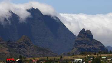
This is the star of Reunion Island. The Piton de la Fournaise is the most visited tourist site on the island. Since August 2014, the Cité du Volcan, at the Plaine des Cafres, has been unveiling the secrets of this huge giant, standing at 2,631 metres. This turbulent volcano can be seen from all over the island, even when the clouds are gathered around its peak… It erupts every nine months on average, making it one of the most active volcanoes in the world.
Reunion Island’s Piton de la Fournaise is around 500,000 years old and since 2010, it has been a member of the prestigious club of natural treasures listed as World Heritage sites by Unesco, due to their exceptional universal value. This honour is shared with the other Reunion Island volcano, the Piton des Neiges as well as the natural cirques and rampart of the island: all of which belong to La Réunion National Park. The fantastic biodiversity of this extraordinary natural reserve is protected and studied.
Piton de la Fournaise: the perks of an angry disposition
The surrounding slopes of the Piton de la Fournaise, which actually covers almost a third of the island’s surface area, are far from being barren lava fields! On the contrary, after molten rock has passed through these parts, the vegetation comes quickly back to life. White lichen appears first, providing a light colour to sections of the slopes of the volcano, such as the cliffs of the Grandes Pentes. Then other plant species start to grow in the crevices of fertile ground: ferns, bushes and little by little, the forest takes over once again.
Unveil the mysteries of the Piton de La Fournaise
To understand this captivating phenomenon, follow the educational trail in the Fouqué Chamber, the area surrounding Dolomieu crater which appeared in 1791. This is the volcano’s biggest crater and its physiology changes with each eruption. It’s not possible to go the whole way around the Piton de la Fournaise, but a marked path will take you to the observation point at the top on the north side, and it’s absolutely incredible!
You’ll see a lunar desert, as far as the eye can see, very similar to the Plaine des Sables , which we crossed to reach the peak of the Piton. These landscapes that appear to be from another planet, are not inhabited: the eruptions and lava flows take place inside the chamber and on the slopes on the south-east side. That means there’s never any real danger for the people of Reunion.
Did you know ?
In 1977, lava flow reached the main road in the town of Sainte-Rose, but it stopped at the threshold of the Notre Dame des Laves church, as if by miracle! Following this event, the Observatoire Volcanologique was created so that the volcanic activity could be monitored, and the eruptions anticipated.
A land shaped by eruptions
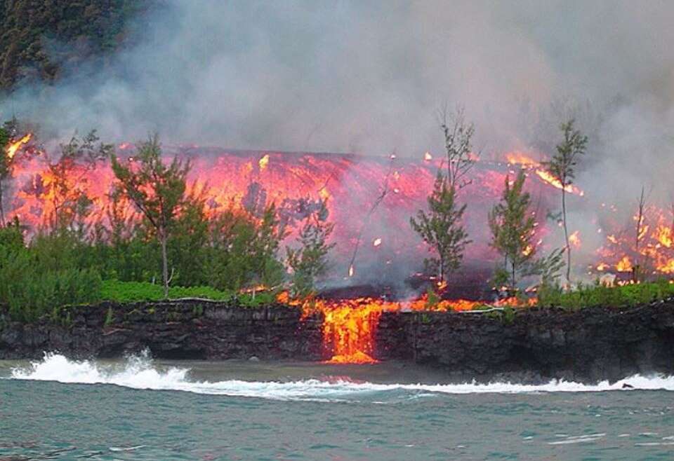
When the Piton de La Fournaise erupts, it doesn’t only change the morphology of the volcano, it also changes the island itself! After the volcano erupted in April 2007, 45 hectares of new land were recovered over the water. Near the Pointe du Tremblet lava flow reached the ocean, and extended the surface area of Reunion Island. After that, some previously unknown species were discovered off Saint-Philippe. Even more proof of the rich natural heritage of Reunion Island!
Volcano walks
PITON DE LA FOURNAISE: AIM FOR THE MOON!
Futuristic hikers
Strange two-wheeled devices in silent procession cross the Plaine des Sables, an impressive desert of red and ochre. A promising prelude to the discovery of Piton de la Fournaise, Reunion Island’s most famous volcano, a 2,631-metre giant that’s still active. You almost wonder how these tiny vehicles overcome the issue of weightlessness. And how the astronauts breathe without helmets or spacesuits… Are they space conquerors steering the latest Explorer model? No, they’re curious hikers trying a new experience, standing on gyropods. The gyropod is a kind of large electric scooter that moves forward when the driver leans slightly forward on the handlebars. Top speed: 20km/h.
But these futuristic explorers are not in a race… they’ve come to (re)discover the wonders of this extraterrestrial volcanic world. The top of the Pas de Bellecombe offers a captivating view of Piton de la Fournaise. The expedition then heads towards the Piton de l’Eau, the island’s only volcanic lake, and leads around it to reveal the fragile plant life and incredible geological features.
A must-do
The Marmite Lontan gîte and the Volcan gite offer hikers traditional meals and overnight stays. The Cité du Volcan on the Plaine des Cafres is well worth stopping to visit. This educational centre reopened in August 2014 to offer children and adults a fun approach to learning all the secrets of the Piton de la Fournaise, with innovative, interactive facilities.
Discover the volcano as if you were there
Explore Reunion as if you were there, with Google Street View. The rocky, volcanic soils of the Piton de la Fournaise will reveal all their secrets and you can even admire some key attractions such as the Chapelle de Rosemont and the Pas de Bellecombe.
Reunion Island, a hiker’s paradise
Reunion Island is the perfect place for hiking. For all hikers, whether you’re a beginner or more experienced, the island has over 900 km of marked trails. These trails cross over varied environments, all breathtakingly beautiful: dense tropical forests in the east; savannah or sugarcane fields in the west; the lunar landscapes of the volcano, coastal walks with the sound of the waves.
This unique variety of landscapes has earned Reunion Island and its Pitons, Cirques and Ramparts a place on the list of natural treasures, classified as world heritage by Unesco, since 2010.
Reunion Island hiking trails for all levels of ability
The “marmailles” trails (for kids), family-friendly walks, evening walks or along the seaside, hiking trails in the mountains: Reunion Island has a wide variety of trails and itineraries on offer. Whatever your level, there’s a trail suited to you, to explore the wonders of the island at your own pace. The island is well-known thanks to some of these trails and many visitors take to them every year. One of the must-see hiking trails of Reunion Island will lead you to the magnificent Piton de la Fournaise, the peak of the Mascarene islands.
Every year, around 400,000 visitors take on the climb up the famous volcano, at their own pace. Along the marked trails, this two-hour walk will take you across lunar landscapes and craters, to the Plaine des Sables, and then the climb up to the peak, at an altitude of 2,632 metres (access to the area depending on current regulations).
The most beautiful beaches OF REUNION ISLAND
Come and discover the most beautiful beaches of Reunion Island
Where can you go swimming on Reunion Island ?
Due to the particularly abundant marine wildlife, swimming, water sports and diving are forbidden within a perimeter of 300 m around the Reunion Island coastlines. The Reunion Island lagoons are protected by a coral reef.
However, there are special swimming areas that are safe and with lifeguards, much to the joy of those looking to enjoy the waves.
Checklist for enjoying
THE MOST BEAUTIFUL BEACHES OF REUNION ISLAND
– Relax on the warm sand, in the shade of the coconut trees or casuarinas… An exceptional place for an afternoon nap in a picture-perfect setting.
– Appreciate the peace-and-quiet of the lagoon and try out some new water sports (transparent kayak, stand-up paddle, sailing, etc.).
– Admire the colourful fish of the Natural Marine Reserve and dive into the underwater depths of Reunion Island.
– Let the gentle winds carry you and take the time to enjoy the sunset over the Indian Ocean, from one of the beach restaurants.
– Play beach-volleyball or petanque on the beach and enjoy an impromptu picnic lunch with friends on the grass, in the shade of the casuarinas.
– Walk along the coastal path.
Pools and waterfalls ON REUNION ISLAND
Refreshing discoveries
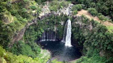
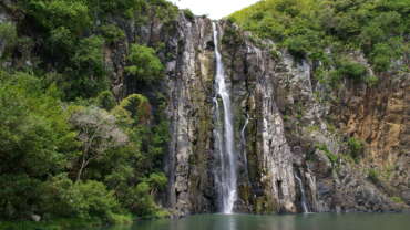
Reunion Island abounds with waterfalls and pools surrounded by luxurious nature. There are almost a hundred, scattered all over the island, ensuring a refreshing climate. Some are more accessible than others, by car or hiking, with or without a pond for a tempting swim in a magical setting or simply for contemplating this truly natural paradise.
Waterfalls on Reunion Island
Nestled in a breathtaking natural backdrop, each waterfall and river has an element of surprise. Some, like Trou de Fer, the highest waterfall in the French territory (725 metres) is listed among the most spectacular sites on the planet. It is perfect for high-level canyoning.
A waterfall of activities
In the heart of forests and mountains, in the cirques, in the white waters of the east, rivers and pools are very popular picnic sites, ideal for a range of activities all year round: swimming, canoeing, rafting, canoraft, water hiking and canyoning. The waterfalls, named Langevin or Grand Poulette Voile de la Mariée, Takamaka, Trou Noir, Niagara, and rivers named Marsouins, des Roches, Bassin de la Mer each have their own unique identify. Inquire before heading out.
Reunion Island National Park
An abundance of national treasures
Established in 2007, this protected space is the beating heart of Reunion nature. It represents 42% of the island’s total surface area and it is home to very rare flora and fauna, a remarkable biodiversity, the safeguarding of which is essential.
Discover the National Park of Reunion Island
Reunion Island National Park is the island’s geographic centre, covering more than 100,000 hectares, that is 42% of the island’s total surface area. It is also the heart of its national land assets. Created in 2007, it has the task of protecting and promoting a unique heritage: numerous species of animals, insects and plants only exist in this region and cannot be found anywhere else on the planet. The park ensures the conservation of a delicate balance, in magnificent land that everyone should respect.
Thanks to the park, knowledge about the flora and fauna has developed, and it has also become more accessible to the public. Scientists study the exceptional biodiversity and the teams on the ground share their passion with the visitors, even though it is difficult to see endangered species. For example, two large marine birds: Barau’s petrel and the Black petrel. Other indigenous species: the Reunion cuckooshrike, a bird in danger of extinction, the zoizo green glasses or zoizo green; the Marsh Maillard, the island’s only bird of prey; the papilo phorbanta and salamis augustina butterflies, which are endangered; or the Reunion Island day gecko.
A diverse space with lush nature
As regard the park’s flora, this varies depending on the altitude and the microclimates: 850 indigenous species have been counted. This seems a lot but in fact it’s not, given that 2,000 species have been introduced by man during Reunion Island’s history. These extraordinary plants, flowers and trees grow in rain or cloud forests, on moorland, in gorges and on astonishing reliefs, formed by the volcanic eruptions, erosion and lava flows. Or even as a result of volcanic vents collapsing, which created the spectacular Salazie, Mafate and Cilaos craters.
These three fascinating regions and their ramparts, as well as the two huge volcanoes of Piton de la Fournaise and Piton des Neiges have been part of UNESCO’s list of World Heritage Sites since 2010, due to their outstanding universal value. A formidable international recognition for the Reunion Island National Park, which represents a highly diverse space. It has an inhabited interior, since two populated areas can be found within its borders: the islets (isolated hamlets) of Mafate and that of Salazes (col du Taïbit, in Cilaos crater). Their inhabitants are the only permanent residents living right in the heart of the National Park: they constitute the very essence of Reunion Island, the cornerstone of creole culture and identity, imprinted by a traditional way of life and a strong relationship to the land.
Indeed the park has a cultivated interior, in the middle of untamed nature. This concerns livestock farming areas (Piton de l’Eau), crop and geranium production (Sans-Souci), cultivated forests and tea plantations (Plaine-des-Palmistes). Indeed, these agricultural activities were already there before the creation of the park and its charter enables them to blend seamlessly with the natural environments which surround them, ensuring a harmonious coexistence between man and his environment.
The plains ACROSS THE PASTORAL PLAINS
The plains of Reunion Island are found on the high plateaus and are a delight for families and walkers
The gentle plains
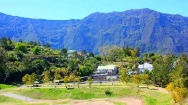
A mountain sitting on the ocean. That is pretty much how we could describe Reunion. And yet it is so much more than rugged terrain and beaches bordering the azure blue sea. Gentle plains nestle in the upland areas. The only road that crosses the breadth of island weaves its way across these plains to link Saint-Benoît in the east to Le Tampon in the west, crossing Plaine-des-Palmistes and Plaine-des-Cafres. The first of these plains is a lush green plateau, dotted with peaceful pasturelands, craggy pinnacles formed by volcanic activity, invigorating waterfalls and rich endemic vegetation. You will be more than tempted to take a walk along one of the many hiking trails through the Bébour-Bélouve forest. Or up to the Biberon waterfall which cascades down from a height of 240m into a small pool surrounded by lush vegetation.
The botanical paths on the Petite Plaine and the Piton des Songes take you on a discovery of a series of trees with some pretty unusual names, such as bois maigre (Nuxia verticillata), bois de papa (Tambourissa elliptica), bois de fer (Sideroxylon majus), bois de cannelle (Ocotea obtusata), bois de violon (Acalypha integrifolia), bois de pomme (Syzygium Cymosum), and so on. The Domaine des Tourelles, devoted to promoting regional crafts, is a great example. Other Creole houses and gardens can be found along a trail that crosses the area.
Fragrant, lively plains
Plaine-des-Cafres is made up of farmed fields and natural landscapes ideal for various sports such as hiking (up to Piton des Neiges, for example), horse-riding, mountain-biking and so on. This high plateau is crossed by the volcano forest road that runs up to Piton de la Fournaise, through Bourg-Murat and its Cité du Volcan visitors’ centre.
Other high plains can be found in the centre of Reunion, including the plains of Affouches, Chicots, Lianes, Fougères to name but a few. To the south, Plaine Grègues sits at the lowest altitude and is the home of “Indian saffron» or turmeric growing, a spice emblematic of Réunionnais cuisine. It even has its own “Maison” at Saint-Joseph, which shows how it is transformed from the plant root to the spice.
A visit that will spice up the stories of your travels !


