Margiana-(Margush)
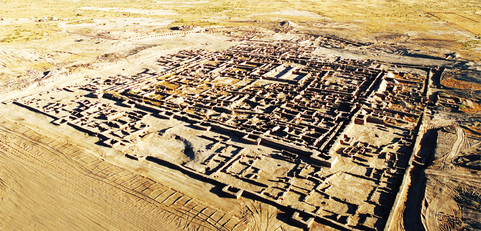
The ruins of Ancient Merv are adjacent to the north-eastern outskirts of the present Bairamali city, located 25 km to the east of the provincial center Mary in Turkmenistan. The State Historical and Cultural Park «Ancient Merv» is the oldest and most completely preserved oasis city along the Silk Roads in Central Asia, which fertile valley referred to ancient and medieval written sources. It originates r tire Paropamiz mountains and hidden under the aesert sands of Kara-Kum.
In the second millennium BC on the fertile an as of the ancient delta of the Murgab River arena 70 km north of the ruins of Merv) one of the r iaest centers of world civilization called Margush a as bom and flourished. Fertile silt coming from mountains, abundance of water and mildate climate a a created favourable conditions for good crops and n e progress of the ancient economy continued for several centuries. The real name of that state on the Murgab River in the ancient times remains unknown. This name is derived from the word Murg that makes up the basis for the name of the life-giving water maery – the Murgab River. Margush is still the oldest known name of the country, which is contained in the famous Behistun inscription of Achaemcnid’s king Darius 1. In the part of the Avesta, the sacred book of the Zoroastrians, called the Videvdat the Merv oasis appears under the name Mouru, Mourv. The ancient Greek historians that came to know Central Asia named this country Margiana for easier pronunciation. In the Middle ages under the influence of the Arabic language the country was called Merv and nowadays this is name of Mary administrative region of Turkmenistan.
The Holly Murgab River, feeding the oldest farmers’ fields, the founders of the original civilization of ancient Eastern type, not only gave the name of a fertile oasis, but forced people to leave their settles and to follow the river. Its riverbed as well as the riverbeds of many world rivers was gradually moving westward and the people followed the river. Only in the early 1970s, a largescale archeological research and excavations began to depth of the desert and discovered many hundreds of settlements here. Archaeological discoveries of the second half of the XX c. in the north Afghanistan and Southern Turkmenistan gave exact proof for close relations between Margiana and Baktria. Archaeological research showed that in the second millennium BC center of life has shifted from agricultural oases of piedmont zone of Southern Kopct-dagh plains of Turkmenistan to the ancient delta of Murgab river and fertile valleys of Bactria, that include northern Afghanistan, the south-westem parts of Uzbekistan and Tajikistan and south-eastern parts of Turkmenistan.
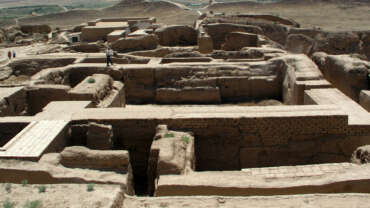
The general description of the architecture of the territory of Margiana leads one to opine that it represented a unique monumental complex of palaces and temples, the large known monuments of the Bronze Age, and there come into existence an original, unparalleled in ancient Eastern world architecture. Those migrants who stayed in the area of the Murgab River built the monumental palaces and temples, melted metals, and created pieces of art not inferior to those from the advanced centers of the world. All the creations of these people clearly testify that in the present Kara-Kum desert there existed a Among the sands of the eastern Kara-kum the archeologists found and excavated the monumental castles and temples that demonstrate mature building art and monumental architecture. Its plan and decoration are in no way inferior to any other analogous buildings of this period. This gives strong arguments in favor of the hypothesis of the existence of an independent architectural school in southern Turkmenistan in this period.
The features of its distinctive architecture are the following: isolated plan, strict orientation to the cardinal points, symmetry. Such required planning elements as the courtyard, the bypass corridor (or the system of corridors) the citadel walls, crowed by towers of square or round form were also used there. The unique plot, mosaic decor and performance technique of the Gonur Depe, make it possible to guess that tradition of architectural mosaic of medieval Khorasan’s masters rooted in the artistic culture of ancient Margiana that was the center of ancient oriental civilization in Bronze Age along with the Egypt, Harappa, IVlesopotamia and China. Obviously Gonurdepe was the capital of this great agricultural civilization. At the beginning of the first millennium BC the capital Margush had already been abandoned. According to the archaeological data life here moved to Yaz-Depe and later to the oldest centre of Merv – to Erk-Kala fortress. The earliest Archaeological evidence testifies the existence of namely urban area, not only populated area in Erk-Kala at the middle of the first mil. BC. It has been suggested that Erk-Kala was one of the developed cities of Ahamenids Empire.
Erk-Kala is not yet completely studied and possible future archaeological discoveries and researches will shed light on many pages of its history, which has reen completely forgotten in the Middle Ages, and fiat has become the cause of many legends about the oldest centre of Merv.
Medieval author Ibn Faqih-Haniadansky gives r.c of these legends, reporting that Merv has been ruft by Alexander the Great (known in the East under the name Iskender Zulkamayn), and that the citadel in it has been constructed by the legendary king Tahmuras, who has taught his people to spin sheep wool, to make clothes and to weave carpets. But now it is clear that Alexander the Great had not build a new city here, but has strengthened the existing walls and named it Alexandria Margiana. This is present settlement Erk-Kala, the walls of which form a circle in plan. The Greek soldiers have been settled here. Subsequently, after the breakup of Alexander’s empire under the rule of the Seleucid monarch Antiochus Soter town border growing, new walls strengthening in foim almost square with small distortions. The eastern territories soon became the part of the Seleucid Empire. The Seleucid king Antiochus 1 Soter (281 -261 BC) rebuilt it and named it Margiana Antiochia; it is identified with Erk Kala and Gyaur Kala. He began a massive expansion of the city at Merv: the earlier city of ETk Kala was converted into a citadel and a vast new walled city was laid out. It was occupied for some 1500 years, throughout the Parthian and Sasanian periods and into the early Islamic period. The Parthians (from c 250 BCE), and then the Sasanians (from 226 CE), developed Merv as a major administrative, military and trading centre. The defences were repeatedly rebuilt and strengthened and the vitality of the city is reflected in the numerous building programmes and in the wealth of objects recovered from the excavations within Gyaur Kala.


