Heritage Sites of Guam
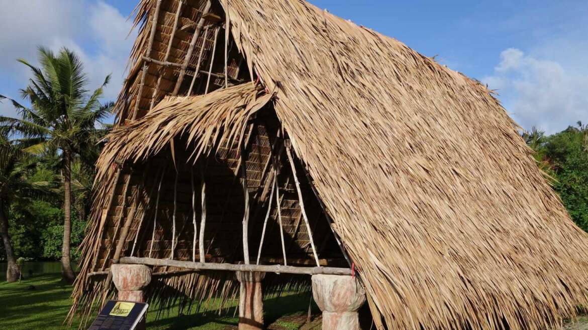
Historical landmarks, coupled with the natural beauty of Guam, offer numerous sights of interest. Latte, which served as foundation pillars for the thatched huts of the Chamorros, are found in parks and out-of-the-way jungle areas. The graceful remains of Spanish buildings, the Plaza De España, and stone bridges may be seen in Hagåtña, Guam’s capital. In other locations throughout the island, the Spanish influence is clearly visible in the architectural design of Guam’s southern homes and villages.
The list of Guam’s attractions is virtually endless. Follow the links under our main “Sightseeing Guam” tab to explore landmarks in central, southern and northern Guam, along with our capital city of Hagåtña. We can’t wait until you start exploring our island!
Tarague
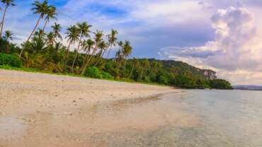
Tarague is a geographic place name given to the northern littoral of the island of Guam, between Mergagan Point to the west and Tagua Point to the east. The landscape at Tarague consists of the sea and coral reef, the lagoon and coastal plain, a limestone beach and towering limestone cliff.
The vegetation at Tarague, several species of trees, shrubs, vines, ferns and grasses, including the valued ifil hardwood. Freshwater is available in the form of a porous water lens that can be reached through digging wells. There is also a limestone cave with fresh water at Tarague. A number of surge channels created by freshwater runoff are present along the coastal margin.
The presence of pictographs (cave wall drawings) inside a limestone cave at Tarague was initially noted by Hans Hornbostel in the 1920s. Currently, Tarague is located within the Andersen Air Force Base, and access to the Tarague area is restricted.
Talofofo
The municipality of Talofofo is located in south-central Guam on the eastern coast of the island. The area extends from the shore and deep into the interior valleys along the Ugum and Talofofo Rivers. The name of the ancient village of Talofofo probably has its origin from the phrase “entalo’ i fe’fo’,” which means “between the cliffs,” or even from the word “fo’fo’,” which means a bubbling stream.
Archeologists believe most of the pre-Spanish era inhabitants lived in settlements along the Ugum and Talofofo Rivers. Artifacts in the Talofofo Caves indicate these sites were occupied and used as well, if only seasonally or for short periods at a time.
After the Spanish reducción of the late 1600s which displaced the Chamorro natives from the northern villages and the other Mariana Islands, the residents of Talofofo were presumably shifted to Inarajan and the main village was abandoned.
Years before the first American administration of Guam in the early 1900s, people had already been moving back into the Talofofo area to farm and hunt. Small plantations had been set up along the valley of the Talofofo River. Latte sites, however, still were visible in different parts of the valley, but were largely avoided. In 1912, a chapel supposedly was built close to the mouth of the Talofofo River. By 1918, the Naval governor William Gilmer appointed a commissioner for Talofofo, and the residents decided to move their village up to the plateau.
Although Talofofo was previously considered part of Inarajan by January 1931, Inarajan was divided into two districts. Talofofo was designated north of the Talofofo, Ugum, As Mulato and Atate Rivers, while the district of Inarajan was to the south. However, the area remained largely unoccupied, with few houses, and used mostly as ranch land.
During World War II, Talofofo Bay was one of the landing points for the invading Japanese forces on 10 December 1941, although the original landing site was supposed to be Ylig Bay. By 1944, the Japanese had begun to fortify the island in anticipation of the arrival of American forces, and built gun placements and pillboxes in the cliffs near the bay.
After the war, the American military government built the new community of Talofofo in the hills where it now stands.
Tourist attractions in Talofofo include the jungle riverboat cruise which transports visitors inland from Talofofo Bay to a cultural village display and latte site. The inland hills are also popular for hiking and off-roading activities.
Sumay
Sumay’s history dates before the Spanish colonial period, although not much is known about its pre-contact history. When the Spanish proclaimed Guam as theirs, Sumay’s chieftain was supposedly among those who held strong opposition to the Spanish colonizers, although the Spanish government eventually gained control. Sumay, like other villages, was centered around the Catholic church.
The Spaniards kept a settlement at Sumay, and its easy access to San Luis de Apra Harbor made it a favorite anchorage town for whalers and other sailors. Sumay grew into a thriving little port town in the 1800s.
Much of the naval shipping operations were situated along this coastal village when the American government took over. The Trans-Pacific Cable Company anchored its station at Sumay in 1903, linking Guam with both Asia and the United States. Pan American Airways landed its China Clipper at Sumay in 1935, and built Guam’s first hotel there.
Because military shipping and communications centered around Sumay, it was one of the first areas to be bombed when the Japanese attacked on December 8, 1941. The people of Sumay fled and scattered inland to their small ranches in the jungles.
After World War II was over the Navy did not allow the Sumay residents to reclaim their home, saying they needed the property for U.S. Naval Base, Guam. The former Sumay residents were eventually relocated to the newly created village of Santa Rita.
Spanish Forts
In order to protect Spain’s interests in Guam and its Pacific trade routes, several fortifications were constructed to defend the island. Beginning with the first stockade in Hagåtña in 1671 and ending with the semi-reductos (half-enclosed parapets) in 1835, the Spanish administration built fourteen fortifications of various types and dimensions on Guam. Most of these defensive structures were open batteries designed for cannons to fire through embrasures. Six fortifications were constructed in the village of Hagåtña. Four fortifications were built to protect Umatac Bay. Three fortifications were built to defend Apra Harbor and one unnamed battery was assembled in Merizo to protect the anchorage outside the village.
Haputo
Haputo, which covers 252 acres of coral reef and limestone forest, was designated an ecological reserve in 1984. Haputo is also listed in the Guam and National Registers of Historic Places.
Historic accounts from the early Spanish era mention that the village of Haputo (sometimes spelled Apoto) was burned in 1678 by Spanish soldiers. In 1680 the surviving residents of Haputo and all the other northern villages of Guam were forced to relocate to Hagåtña.
Although the village was abandoned, it still was recognized by name and located on early European maps of Guam.


