Hiking in Montserrat
Hiking is one of the most popular recreational activities in Montserrat. There are numerous foot paths that crisscross the island, many of which have been in use for centuries by persons seeking access to distant villages and agricultural land. There is opportunity for hikes of varying difficulty, length, and scenery.
Big River
Duration: 1.5 hours one-way
Distance: 0.7 miles
This is a strenuous section of trail connecting the agricultural lands at Upper Blakes to a narrow upland saddle. It twists, ascends and descends several times, crossing and then rising up the rocky ghaut of Big River before a steep ascent to the eastern ridge approach to Katy Hill.
Blackwood Allen
Duration: 2 hours one-way
Distance: 1.2 miles
This trail follows a series of steep climbs and descents through a lush portion of the Centre hills, including a formerly active agricultural village known as Underwood. There are two sections, east and west. Both are often done together, or you can shorten the journey by exiting the forest via the Underwood trail which bisects the eastern and western portions of the Blackwood Allen near the half-way point.
Dry Waterfall
Duration: 3 hours round trip
Distance: 1.2 miles
This trail is often wet and slippery with dramatic cliffs rising on either side. There are several moderate gullies to cross, and some of the trail climbs directly through the rocky bed of Soldier Ghaut. The actual waterfall is about 100 feet high, but only runs in the rainy season or after heavy rainfall. It is still worth the hike even when the weather has been dry! The return journey retraces the same path by which you entered.
Duberry-Cassava
Duration: 45 minutes one-way
Distance: 0.5 miles
This can be done on its own or serve as connector between The Cot and the Oriole Walkway trails. It is a short hike with mostly gentle slopes through the dry forest. There is a marked picnic area in a clearing in the forest near to the remnants of the arrowroot factory and not far from the southern end of the trail.
Hope Ridge Trail
Duration: 5 hours
Distance: Depends on where you finish Level
One has three options from which to start and end this hiking trail. You can start at MVO, The Cot, or Oriole Walkway. This trail takes you into the heart of the Centre hills. It takes you to Elfin Forest at Baker Hill Mountain. Cloud forest, elevations of 2300ft, nice panoramic views, prime forest vegetation. Only for fit Avid hikers.
Jackboy Hill
Many people make the return journey up and down Jack Boy Hill, however those seeking a longer and even more strenuous experience may also continue on from the summit to Katy Hill and points beyond.
Jackboy Hill Visitor Centre
Duration: 2 1/2 hours
Distance: 0.8 miles
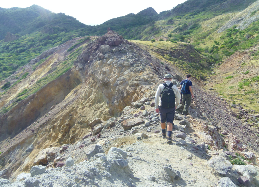
The trail begins just above the Jack Boy Hill Visitor Centre and rises steeply up the western slope of Jack Boy Hill. There are several opportunities to look towards the Tar River Valley in the southeast. From the summit, unless you are planning to continue on to Katy Hill, turn and retrace your steps along the same path that you ascended.
Katy Hill South
Duration: 3.5 hrs one-way
Distance: 1.6 miles
Connecting Barzeys to the Blackwood Allen trail, this offers a short hike through former agricultural lands and enters the dense forest. Although affording mostly modest slopes, there are a couple of sections that can get slippery. At the junction with the Blackwood Allen trail turn and retrace your steps along the same path that you ascended unless you plan to continue on the Blackwood Allen and end your hike elsewhere. Enjoy panoramic views of Montserrat’s eastern regions.
Katy Hill Trail System
Duration: Duration and level depends on where you start or wish to end hike
This is a trail system where you will definitely need a guide, as the trail becomes quickly overgrown due to almost constant moisture and it is easy to lose one’s way. Note also that it is easy to become lost or disoriented high up in the fog that is often present at the summit. Hikers should be prepared for a very strenuous experience, as well as mud and moisture in the Katy Hill cloud forest. Be sure to pack snacks and plenty of water to keep your energy up. There are several route options to choose from.
Oriole Walkway
Duration: 2 hours one-way
Distance: 1.3 miles
This is the most popular hiking trail in Montserrat. With a guide, you are very likely to see and/or hear the national bird from this trail. From either direction, the trail ascends gently then steeply to the top of Lawyer’s Mountain. A short spur to a clearing at the highest point of the trail (1287 ft above sea level) affords breathtaking views of the island to the north and south.
Rendezvous Beach
Duration: 2 hours round trip
Distance: 1.3 miles
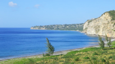
Take a modest hike to Rendezvous Bay, where wonderful swimming and snorkeling opportunities await you at Montserrat’s only white-sand beach. Use the same trail to go and return, which originates behind the concrete block company in Little Bay and climbs steeply over a saddle, descending steeply into the Rendezvous Valley and taking you directly to the beach. There are no facilities at the beach, just you and nature. Snorkeling gear can be rented from Scuba Montserrat in Little Bay. Water, a hat and sunscreen are advised, as there is very little tree cover. Although this is a moderate hike, there are some dangerous parts and you should take extra precautions.
The Cot Duration
Duration: 1.5 hours one-way
Distance: 1.6 miles
The trail begins just south of the National Trust on an unpaved road heading uphill. The path winds up a gentle slope broken occasionally by small farms. From the top follow the arrow and trail northwards through ferns and fruit trees. You will then descend to a point where you can either rejoin the main road at Runaway Ghaut or a short walk southward to the National Trust.
Underwood
Duration: 45 minutes
Distance: 1.2 miles
Connecting Barzeys to the Blackwood Allen trail, this offers a short hike through former agricultural lands and enters the dense forest. Although affording mostly modest slopes, there are a couple of sections that can get slippery. At the junction with the Blackwood Allen trail turn and retrace your steps along the same path that you ascended unless you plan to continue on the Blackwood Allen and end your hike elsewhere.
Upper Blakes to Katy Hill North
Duration: 3 hours one-way
Distance: 1 mile
From Baker Hill, the first part of this trail rises moderately, traversing dense forest. Farther along to the east approaching Katy Hill, the terrain becomes steeper and more uneven with a very challenging final ascent to Katy Hill’s northern summit.


