Berlín and Alegría
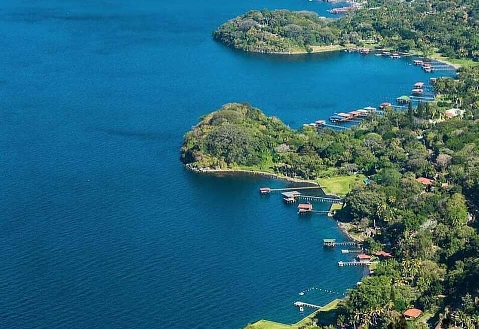
The Sierra Tecapa – Chinameca, is a volcanic mountain range with at least five volcanic cones included: Tecapa Volcano, Usulután Volcano, El Tigre Volcano, Laguna Seca El Pacayal and Laguna Alegría; It includes two iconic cities for tourism in El Salvador: Alegría and Berlín.
Alegría is a municipality in the eastern part of the country, department of Usulután, located 142 kilometers from the capital San Salvador, driving you along the Pan-American Highway.
Founded in the mid-seventeenth century by Yaquis or Pipil tribes, its original name was “Tecapa” which means “Laguna de las Piedras” (Lagoon of stones).
With an approximate area of 43.2 km², the Tecapa volcano, of 1,594 MAMSL, stands out in its geography, whose crater contains the Alegría Lagoon which formed after the volcano erupted; Its climate is around 21 ° C in the highest parts, with a maximum of 27 ° C in the month of April, and a minimum of 15 ° C in December.
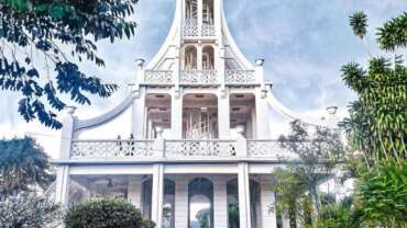
Its church “San Pedro Apóstol” built in 1792, is one of its tourist attractions, being its main economic heritage the cultivation of coffee.
The tourist activity is beautifully set by its cobbled streets and its natural environment of diverse vegetation, ornamental and fruit plants; which offers tourists accommodation, tours, local cuisine (totopostes, alfajores, quality coffee, among others), restaurants with stunning views of the mountains, handicraft shops, the birthplace of renowned Salvadoran writer Alberto Masferrer and the former President of the country, Manuel Enrique Araujo.
On the other hand, Berlín is located in the Sierra Tecapa-Chinameca-Alegría, in the mountainous area of north-central Usulután, located 112 km from the capital city San Salvador. Founded in 1885, the name was suggested by Don Serafin Brennen, a German citizen, based in the valley.
Originally in the area were settled Lencas villages and later the Pipiles, generating a great cultural and linguistic influence.
Berlín located between 1023 and 1200 MAMSL, has a pleasant climate with average temperatures of 21º, and is surrounded by mountains in which the Pelón, El Pinal and Guandique hill stand out; its tropical vegetation with abundant coffee plantations with many pepeto trees that shade the coffee plantations.
The generation of electricity using geothermal resources is one of the main attractions for the tourist activity of Berlín, being only 3 kilometers from the power generation plants from the geothermal steam that is currently managed by the company La Geo (State company).
The tour is explained by local tour guides, complemented by an interpretive museum, a pool with thermal water, saunas, interpretive trails and viewpoints.
The beautiful architecture of the city center includes old houses with stamped sheet walls imported from Belgium, a construction modality that took place between 1925 and 1930, and which represents the historical pride of the city.
Another local tourist attraction is the local tour to areas of sowing grains and vegetables, to ponds where the cultivation of tilapia fishes and shrimp is practiced, and walks in the middle of the coffee forests, enjoying the observation of both native and migratory birds.
Santa Ana Volcano / Ilamatepec
Located about 15 km northeast of the city of Sonsonate. It is contiguous to Cerro Verde and to theof Santa Ana Volcano this area is named The Complex of Volcanoes. It is considered one of the youngest volcanoes in the world and still active having occurred its last eruption in October of 1966. It has an elevation of 1910 msnm According to the professor and historian Salvadoreño Jorge Lardé and Larín “at the beginning of century XVII formed a hollow , To the south-east of the Santa Ana volcano, a crater from which a column of thick, black smoke constantly erupted with a strong smell of sulfur and fire from time to time.
It was a volcano without cone, a volcano in formation to which the natives comarcans gave the name of “infiernillo of the Spaniards” (1633). After horrendous eruptions, the cocoa plantations and other plantations of the old Izalcos province were severely damaged. The main ones were those of 1722, 1745, 1753, 1762, 1765, in February 1770 a cone of magmatic materials was formed, Late eighteenth century was visible from long distances. It can then be considered that the volcano of Izalco was “born” in the year 1770 and has remained in activity almost continues until February 1957, when there was a violent eruption, followed by a weak and intermittent activity during the rest of the year. Already in 1958, the Izalco had ceased all activity during the rest of the year, in 1958, the Izalco had ceased all activity. It was at rest until October 28, 1966, when a small eruption occurred, by an embrasure that formed 550 meters below the summit on the SSE slope of the cone, which lasted a month. During that time, two lava flows descended at a distance of 1,200 meters. At present, you can observe fumaroles that leave the main crater of the volcano. The Izalco can be considered as an active volcano at rest.
This impressive volcano can be climbed in only 2 and a half hours, expeditions to its summit depart from Cerro Verde Park at 11 am every day, these are escorted and driven by local gypsies
Izalco Volcano
Located about 15 km northeast of the city of Sonsonate. It is contiguous to Cerro Verde and to theof Santa Ana Volcano this area is named The Complex of Volcanoes. It is considered one of the youngest volcanoes in the world and still active having occurred its last eruption in October of 1966. It has an elevation of 1910 msnm According to the professor and historian Salvadoreño Jorge Lardé and Larín “at the beginning of century XVII formed a hollow , To the south-east of the Santa Ana volcano, a crater from which a column of thick, black smoke constantly erupted with a strong smell of sulfur and fire from time to time.
It was a volcano without cone, a volcano in formation to which the natives comarcans gave the name of “infiernillo of the Spaniards” (1633). After horrendous eruptions, the cocoa plantations and other plantations of the old Izalcos province were severely damaged. The main ones were those of 1722, 1745, 1753, 1762, 1765, in February 1770 a cone of magmatic materials was formed, Late eighteenth century was visible from long distances. It can then be considered that the volcano of Izalco was “born” in the year 1770 and has remained in activity almost continues until February 1957, when there was a violent eruption, followed by a weak and intermittent activity during the rest of the year. Already in 1958, the Izalco had ceased all activity during the rest of the year, in 1958, the Izalco had ceased all activity. It was at rest until October 28, 1966, when a small eruption occurred, by an embrasure that formed 550 meters below the summit on the SSE slope of the cone, which lasted a month. During that time, two lava flows descended at a distance of 1,200 meters. At present, you can observe fumaroles that leave the main crater of the volcano. The Izalco can be considered as an active volcano at rest.
This impressive volcano can be climbed in only 2 and a half hours, expeditions to its summit depart from Cerro Verde Park at 11 am every day, these are escorted and driven by local gypsies
Cerro Verde Park
Since its reopening December 15, 2002 offers all tourists many innovative changes that have been with great effort to date have been satisfactory.
It has an extension of 54 blocks. 3 Interpretive Trails: The Mysterious Flowers Trail, a Nature Trail, and the Old Mountain Trail. Hikes to the volcanoes of Izalco (height 1,980 meters above sea level) and Santa Ana (height 2,381 meters above sea level). Viewpoints, recreational play area, flora and fauna. Sanitarios, parking, cafetería. Local Guides.
The Salvadoran Institute of Tourism has worked alongside the “Tour Guides” to offer foreign and national visitors an interpretation of the Natural Kingdom in an educational and different way. The “Tour Guides” project was created to involve people from the communities surrounding Cerro Verde, with the aim of giving young people an opportunity to learn and dedicate their time to something other than “Agricultural Work”.
Park Keepers (Park Personnel), Tourist Police.
It is located in the western region of the country comprising part of the departments of Santa Ana and Sonsonate.
Enjoy adventure and nature in an important nature reserve. Perfect setting to enjoy contact with nature.
El Boquerón Park
It is considered an active volcano at rest, to reach its summit and to its crater there is an excellent asphalted road that leaves from Merliot City then in the kilometer 20 aprox is a marked diversion that says; “Al Boquerón” there turn left and travel approximately 3.5 km in dirt road which is passable even in a simple transmission vehicle during the summer, If you travel by bus approach the route 103 takes you to 1 km. before the crater and the terminal of these buses is located 100 meters west of Daniel Hernández Park.
Its altitude is of approximately 1950 MAMSL and the temperature in that place varies from 18 to 22 degrees Celsius in the day and descends until 12 or 8 degrees Celsius at night.
From this place you will have the most spectacular view of the City of San Salvador and if the visibility is good you can see the Lake of Ilopango, in the area of its top there are exotic flower crops and you will see many other beautiful floral varieties that grow wild , as well as cypress and pine trees.
It is a nice place for people who like to observe birds, to be in contact with nature in an atmosphere of pure air and security, as well as to capture sunrises with their camera. On the way to this volcano on the paved route will find sales of beautiful flowers that are cultivated in the hills of the volcano, as well as you can visit the facilities of Café Miranda which is a coffee farm that offers restaurant service which has a beautiful view towards the northern plateau of the country and the Zapotitán valley and counts with trails to observe the coffee crops of height
According to volcanologist William J. Hart (1978) in ancient times, this volcano was a single mountain that had a tremendous eruption that formed the huge crater of El Boquerón and left after the eruptive cycle, part of the original mountain El Picacho, which is the highest point of the system (1,960 masl). The crater has a diameter of 1,600 meters in its major axis and a depth of 543 meters. The crater’s bank at its highest point measures 1893 MAMSL The distance between the Picacho and the Boquerón measures approximately 2,500 meters. The main eruptions of the volcano of San Salvador were those of 1575, 1770, 1876 and the last of June 7, 1917 that spilled lava flow incandescent covered an extension of more than 5 km forming a wall some meters thick. The indigenous people of San Jerónimo Nejapa were almost surrounded by lavas and their inhabitants were able to escape through a narrow belt not destroyed by the magma.
Chinchontepec Volcano
It is located in the departments of San Vicente and La Paz 7.7 km southwest of the city of San Vicente. Chichontepec means in the Nahuat language “Cerro de dos tetas”.
It is a perfect example of a double peak volcano. One has a flat summit at 2105 m.s.n.m. And the other has a conical shape with a height of 2181 m.s.n.m. Between the two peaks is a hollow that was the crater.
This Completely covered with vegaetation and has no known historical eruptions. However, it can not be considered as extinguished, having hot springs of sulphurous water and fumaroles in its base, known as “infiernillos, in its area are culltiva coffee, flowers and vegetables.
To ascend to this volcano there is a dirt road that departs from the city of Zacatecoluca located 68 kilometers from San Salvador by the coastal road that leads from San Salvador to the east of the country,
From its height are impressive views of the City of Zacatecoluca and San Vicente, Valley of Jiboa as well as Estero de Jaltepeque and part of the Bay of Jiquilisco.


