Nature & Wildlife of Sierra Leone
Pickett Hill
Pickett Hill, situated in the Peninsula near Waterloo, Western Area in Sierra Leone is a 855m (2,805ft) mountain rising above sea level and the highest peak in Freetown and the 13th highest mountain in the whole of Sierra Leone. The Peninsula in Freetown is the only part of West Africa where mountains rise high above sea level giving the capital (Freetown) and the surrounding its magical landscape.
Though a majority of the village’s inhabitants are Muslims, one can still see traditional huts used as shrines where the villagers often seek protection from their gods. Coba water is the last existing village when climbing Pickett Hill but there are other villages-though no longer in existence, that still have some significance in Sierra Leone’s history.
Like Yankeh Soko for example was a village named after a famous and popular herbalist-Yankeh Soko who was very popular within the Western Area. Yankeh used Cut-Nose devils to heal people during her days. It was believed in those days that women should not see the Cut-Nose devil and she being the only woman to have seen and worked with the devil makes her even more powerful. Other villages along the mountain trail include: Magbatha, Kissi Gim, Masophe, Monomor Resting house (Built by the Portuguese around 1700 for travelers between Waterloo and York. It also used to host security personals that used to escort people between the two villages in the 1800s and 1900s) and a few other sites. Even though these villages no longer exist, there are still remains of the lost villages as well as sign posts and road signs.
The three hour experience to the top of the mountain can be both fun and challenging. Despite the challenges to the top of the mountain, there are some interesting sights too. Different bird species and butterflies can be seen along the mountain trail. There is always the sound of a bird singing either closer or far away or the sudden flap of another bird’s wings taking off from a branch. The smell of fresh flowers is sure to awaken the sense of smell.
Tacugama Chimpanzee Sanctuary
On only a 30-minutes drive from Freetown you find the mountain that is home to the Tacugama Chimpanzee Sanctuary. It is famous for its rehabilitation efforts for domesticated chimps, but it is much more than this; Tacugama is ecotourism in its most complete form: eco-lodges, hikes through the rain-forest, a community outreach program, bird-watching, yoga retreats and live Afro Jazz nights are just some of the activities Tacugama is involved with. This article will highlight some of the best parts of the sanctuary and give some more background information on how it was found to make the case that it is one of the most versatile places to visit in Sierra Leone.
Yawri Bay
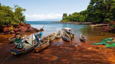
Yawri Bay has rich tidal mudflats and mangroves, which are home to tens of thousands of birds for a third of the year. It supports a major local fishing industry.
Bird Island
Three rivers, Ribbi, Bumpe and Kagboro, each with its own estuary, flow into the Yawri Bay. The bay’s topography and location shelters it from the force of river flow and strong marine currents. It is therefore a suitable spawning and nursery ground for fish, which is one of the county’s most important marine resources. Mean annual rainfall is about 3,554mm. Temperature varies little with season; the mean daily range is 22-31 0C in the dry season and 23-27 0C in the rainy season. Relative humidity at 1500h runs between 60% and 80% annually.
Kangari Hills Forest Reserve
The forest reserve at Kangari Hills is home to an important forest wildlife community, including forest and savanna dependent birds, chimpanzees and elephants.
Location of Kangari Hills Forest Reserve
This reserve is located in the Kunike and Bonkolenken Chiefdoms in the Tonkolili District, Northern Province and the Valunia Chiefdom in the Bo District, Southern Province. It occurs about 210 km east of Freetown. The forest at Kangari is part of a range of hills, the highest being Kang-ari, which is outside the reserve. The hills are drained by a number of rivers and the valleys support swamps suitable for agriculture. The region is the source of two main rivers passing through the centre of the country – The Pampana River to the northeast and the Moa River to the southwest.
Kambui Hills Forest Reserve
The Kambui Hills Forest reserve, which is found in the southeast of the country, is classified as a production forest reserve for the supply of timber to local and international markets. The reserve is situated on the north and south of Kenema town.
Location of Kambui Hills Forest Reserve
The Kambui Hills Forest Reserve is situated in the southeast of Sierra Leone about 300 km south-east of Freetown. The reserve covers sections of the Nongowa, Bambara, Dama and Koya Chiefdoms of the Kenema District, Eastern Province. The two sections of the reserve (Kambui North 20,348 ha and Kambui South 880 ha) are separated by the main highway leading to Kenema town. The forest reserve includes areas encompassing the highest peak in the southern sector of the country, which stands at 645m. The reserve supports catchment areas for a number of reservoirs that supply water to Kenema and surrounding communities.
Tingi Hills
The Tingi Hills is the easternmost outlying forest in Sierra Leone. It has the second highest peak in Sierra Leone, the Sankan Birriwa. The scenic undulating nature of the topography and the rich game and plant diversity are attractive to visitors and scientists.
Location of Tingi Hills Forest Reserve
Tingi Hills Forest Reserve is located close to Sierra Leone’s eastern border with the Republic of Guinea. It occurs between the Nieya Chiefdom, Koinadugu District, Northern Province and the Sando and Lei Chiefdoms in the Kono District, Eastern Province, about 470 km east of Freetown.
The Tingi Hills is the easternmost mountain range in Sierra Leone. The forest reserve includes areas encompassing the massif called Sankan Birriwa, which has two peaks separated by a narrow gorge. Both peaks stand over 1800m, but the northernmost which is 1850m high, is the second highest in Sierra Leone. The terrain is generally rocky, with numerous streams, which have their sources from the massif. These streams are the tributaries of two major rivers in the country; the Mano River, which runs along the border with the Republic of Liberia and Sewa River.
Mamunta Mayosso Wildlife Sanctuary
This site is important for its variety of vegetation types and is one of the few areas in Sierra Leone holding the threatened Dwarf Crocodile. The site is important for the economy and culture of the local people and is the first site to be managed as Wildlife Sanctuary in Sierra Leone. It holds 252 species bird species in a relatively small area and has an excellent ecotourism potential.
Location of Mamunta Mayosso Wildlife Sanctuary
This sanctuary is occurs in the Kholifa and Mabang Chiefdoms, Tonkolili district, Northern Province, about 180 km east of Freetown. Located almost at the centre of the country, this sanctuary supports a wide range of vegetation types. The predominant vegetation is boliland (seasonally flooded grassland) with occasional occurrence of swamps, savanna, secondary forest and two perennial lakes. Water depths in swamps rise to 1.5 m during flooding. Mean annual rainfall ranges from 3048 to 3556 mm, Mean daily temperatures vary from 26-32 0C in the dry season, and 20-30 0C in the wet season. Relative humidity at 1500h varies between 50% and 80% annually. The area is founded on Precambrian-Bintumani granite rocks.
Western Area Peninsula Forest
This reserve is probably the westernmost remnant of West African rain forest. Its fauna and flora are rich and are more affected by seasonal changes than those of the lowland forests in the east. Its situation close to Freetown presents particular threats, but also great opportunities for education and ecotourism.
Location of Western Area Peninsula Forest
This forest reserve is located on the hills of the Western Area Peninsula, on the extreme western edge of the country, about 5 km south of the capital Freetown. The WAPF occupies a narrow chain of hills approximately 37 km long and 14 km wide, with a range of peaks, the highest being Picket Hill in the south, which rises to about 900m. A thin coastal strip lines the peninsula to the north, west and south. Freetown [population 600,000 (1989), but now probably in excess of 1.5 million occupies the northern end and numerous small settlements are found along the roads leading from the capital towards the reserve.
Outamba-Kilimi National Park
Outamba-Kilimi is the only extensive area of savanna woodland and grass savanna, which has any protection in Sierra Leone. Its primate population, especially the chimpanzee population, is exceptional, and it has considerable potential for education and ecotourism development.
Location of Outamba-Kilimi National Park
Outamba-Kilimi National Park (OKNP) is found in the extreme north, about 296 km north of Freetown. It lies adjacent to the border with the Republic of Guinea, in the Tambakha Chiefdom, Bombali District, Northern province. The two areas, Outamba (74,100 ha) and Kilimi (36,800 ha), that constitute the park are separated by a stretch of land 1000 km 2 in size. The vegetation is characterised by a mosaic of grassland, closed woodland and gallery forest. Whereas, Outamba has a predominance of tall grasses and woodland, and patches of closed canopy forest, Kilimi has more grassland and more open woodland. There are traces of Raffia swamp vegetation and riverine grassland in both areas. Outamba has a perennial lake, Lake Idrissa. The land in general is agriculturally poor. The region is drained by several streams, which flow into large rivers of national importance such as the Mongo and Little Scarcies at Outamba and the Great Scarcies at Kilimi.
Lake Sonfon and Environs
This site is situated in a remote area in the mountainous northeast of the country. It is a symbol of traditional belief and place of cultural ceremonies of the local people.
Location
Lake Sonfon is found in the Diang Chiefdom, Koinadugu District, Northern Province, about 350 km north-east of Freetown.
Lake Sonfon is a mountainous lake, 850m asl. It is surrounded by hills with vegetation comprising open grassland, wooded savanna and fringing forest with occasional farm bush. A number of small streams empty into the lake. Water level in the lake rises considerably during the rainy season inundating a much larger area. Annual rainfall in the area ranges from 2286 mm to 2540 mm. Mean diurnal temperatures range from 15-33 0C and 20-27 0C during the dry and rainy seasons respectively. Relative humidity at 1500h varies from 40% to 70% annually.
Gola Forest Reserve
The Gola Forest is the largest area of lowland rain forest remaining in Sierra Leone, and is one of the most important sites for the conservation of threatened wildlife in the ountry.
The three forest reserves, which comprise Gola Forest (Gola North, 45,800 ha; Gola East 22,800 ha; Gola West 6,200 ha), are located in the Eastern and Southern Provinces, about 330km southeast of Freetown. Gola forest covers parts of the Gaura, Tunkia, Nomo, and Koya Chiefdoms in the Kenema District; Barri and Makpele Chiefdoms in the Pujehun District; and Malema Chiefdom in the Kailahun District. The forest forms part of Sierra Leone’s border with the Republic of Liberia. Small areas of forest remain outside the reserves and connect the reserves to each other and to forests in Liberia. Tiwai Island, in the Moa river, west of Gola West is part of the Gola forest IBA.
The Gola Forest is the largest tract of closed canopy, lowland rain forest in Sierra Leone. Gola North is fairly hilly and rugged with most land lying over 300m asl, the highest point being 475 m. The Mogbai is the main river draining Gola North and its catchment area lies at the centre of the reserve. This river discharges east into the River Mano, which runs along the border with Liberia. Gola East and Gola West, which are separated by the Mahoi River, are low lying with swampy areas and a few low hills (up to 150 m). Bagra Hill (330 m) is the highest point in Gola East.
Loma Mountains & Mount Bintimani-Bintumani
Loma Mountains comprise the northernmost outlying forest in Sierra Leone, and the largest area of montane forest in the country. Bintimani peak is the highest in West Africa. The Loma Mountain range has a rich bird fauna, quite different from that of the lowland forests such as Gola.
Loma mountains forest reserve is found in the Nieni and Neya Chiefdoms in the Koinadugu District, Northern Province, about 346 km northeast of Freetown.
The forest reserve is found on a range of hills of wide altitudinal range (400 – 1900 m), the highest being Bintimani Mountain (1945 m), which is the highest in West Africa – west of Cameroon. Many rivers drain the mountain range and two of Sierra Leone’s major rivers have their sources from this region; the Sewa to the southwest and Rokel to the northwest.


