Regions in Cameroon
Adamawa Region
The Adamawa Region and its capital city Ngaoundere, is rightly considered to be one of the most attractive areas for tourists in Cameroon. This region is situated at an average altitude of 1000m (3,000 ft) above sea level. A number of suberb lakes ( Mbalang, Tison) and waterfalls ( Tello, Vina ) make Adamawa a firm favourite with tourists.
Adamawa is affectionately known as the waterShed of Cameroon, due to the many large rivers of the country that find their source here. It is also a hunting ground much appreciated by those who love big game hunting. They encounter optimal conditions for pursing their favourite sports here: game in abundance plus comfortable camps and ranches.
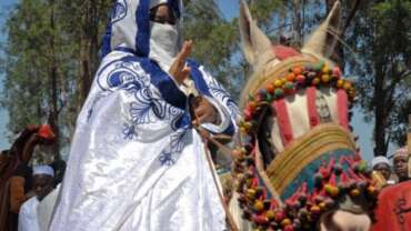
Ngaoundere, at the northern terminus of theNorth-South railway, is a picturesque town; its mosques and the palace of Lamido with its magnificient murals are examples of the characteristically traditional architecture of this region. Of special interest in the town are the very animated market quarter of baladji, the Lamido Palace and the museum.
Center Region
The Centre Region is noteworthy for its humid climate, lush vegetation, folklore and the customs and practices of its inhabitants.
It has an undulating landscape, featuring the equatorial forest and large rivers. This region is suitable for excursions, picnics, ecotourism, agro-tourism and exploration.
Yaoundé, the region’s county town, is also the capital of the country. Because of its location, Yaoundé hosts the headquarters of the Republic’s institutions and with its infrastructure which supports international-class hotels, is one of the preferred destinations for tourists, business people, diplomats, conference participants and academics. Built on several hills, Yaoundé enjoys a picturesque site and a climate relatively fresher than that of the coastal area: maximum temperatures hover between 30 and 33°C and minimum temperatures remain at around 15°C. The great tourist attraction of the region is the Ebogo site at around 60km from Yaoundé, near Mbalmayo.
Yaoundé
With its seven hills and situated practically in the centre of the country, Yaoundé became the administrative capital of Cameroon at the time it became independent in 1960. This area has been inhabited since prehistoric times, as tools dating back at least six hundred thousand years have been discovered. The climate is humid from July to October, whilst the dry season spans November
East Region
The East Region is one of the most extensive regions of Cameroon. It is bordered to the north by Adamawa, by the Central African Republic to the east, the Rep of Congo to the South and by the South and Central Regions to the west.
The East Region is populated, among other tribes, by the pygmies, the first inhabitants of the region who harvest crops, gather fruits and hunt. Friendly and welcoming, they have succeeded in turning their environment into a centre of hospitality visited by many tourists.
Also called “The Region of the Rising Sun”, the East is an ecological zone dominated by huge trees.
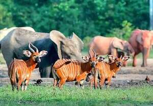
In this area, nearly 1,500 plant species, some of which are wholly or partially protected, as well as over 500 animal species are to be found, mostly in the Dja Reserve which has been named a World Heritage Site. These numerous and varied advantages means that the East Region is particularly suitable for several forms of tourism, especially ecotourism, controlled hunting tourism, photo safaris and exploration.
Far North Region
The Far North Region is fully justified in claiming the title of the most beautiful tourist area in Cameroon. Indeed, being located in the Sahelian zone, its landscape is dominated by the steppes and grassy savannah.
It is intersected by massifs with strange and tormented shapes, such as in the picturesque and enchanted landscapes of the Kapsikis, a favourite haunt of tourists. Rhumsiki is a veritable Mecca for Cameroon tourism.
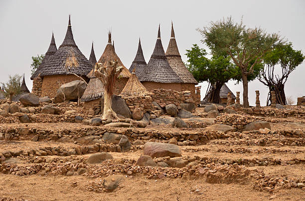
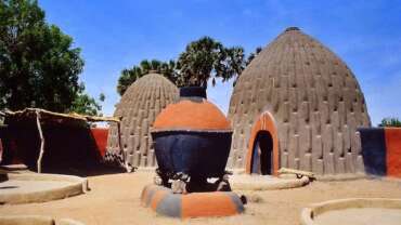
The inhabitants of the Far North, people of the hinterland, have been able to preserve an authentic culture which may be seen via the architecture, artistic creations, handicrafts, the traditions and folklore of tribes such as the Foulbés, Matakams, Toupouris, Massas, Kotokos, Kirdis, Arabes Choa, Mousgoums, Mandaras and the Mofous.
Above all, however, the Far North Region is famous for the Waza National Park. This is the most well-known and most visited park, having the best reputation in Cameroon and all of French-speaking Africa.
South Region
A mirror image of Cameroon as a whole, the South Region is an all inclusive destination.
Like an enormous green mantle, the tropical forests, a zone particularly suited to agricultural and ecotourism, covers the area like an enormous blanket of vegetation and offers visitors the possibility of meeting pygmies, the original inhabitants of the forest.
There are numerous rivers, some larger than others, reinforcing the humid climate of this region and featuring spectacular waterfalls and cascades like those in Lobé and Memve’ele.
The South opens directly onto the Atlantic Ocean with approximately 100 miles of coastline and fine sandy beaches ideal for the development of seaside resorts for tourists.
By choosing to visit the South Region, you unlock the door to discovering monuments and ancient reminders of the first missionaries and the history of the colonization of our country, notably at Kribi and Campo. Also to be admired is the splendor of the natural forest in the Dja Reserve, justifiably declared one of the World Heritage Sites by UNESCO.
South West Region
The South-West Region is one of the two English-speaking regions of Cameroon.
It is distinguished by a rich, permanently green cover of vegetation resulting from heavy rainfall and extensive agro-industrial activity.
The region abounds in a rich array of tourist sites, among which are:
• The relics of buildings dating back to the colonial era, including the palace of the German governor, Von Puttkamer, built at the beginning of the 20th century.
• Mount Cameroon, 4,100m high, which is still an active volcano;
• The Korup National Park, a living natural history museum dating back to 300 million years and enjoying a rare variety of flora and fauna.
• The Limbé Botanical Garden created in 1892 by German horticulturists.
• The Limbé Zoo, open all year round to tourists.
• The Barombi Lake in Kumba, with its luxuriant decor.
The South-West Region also has beautiful beaches of fine grey sand lapped by the Atlantic Ocean.
North West Region
Situated at an average altitude of 1,550m above sea-level, the North-West Region is one of high plateau dominated by a mountain chains reaching a peak of over 3,000m high in the Oku Mountains.
The landscape is covered in grassland and offers a captivating spectacle characterized by the panoramic contrast between plains surrounded by mountain ranges, and deep valleys which sometimes feature rivers interspersed with waterfalls and numerous crater lakes.
Outside the rainy season (from July to October), throughout the rest of the year, the region offers a climate which encourages tourism. It enjoys gentle and fresh temperatures hovering around 22°C.
Bamenda, the region’s main built-up area and regional capital, is both a modern and traditional town. It is an important commercial centre and a main crossroads for routes leading to all parts of the region.
An interstate highway is 350km (220 miles) long known as the “Ring Road”, allows visitors to admire the region in all its diversity: from traditional chiefdom, landscapes, lakes and waterfalls to wildlife reserves, etc.
West Region
The West Region, with its richly endowed natural attributes, is often compared with the Auvergne region of France. It is an undulating region traversed by beautiful rivers interspersed with waterfalls. It offers a series of rounded mountains, a heritage left by extinct volcanoes.
The climate here is temperate and certain areas, such as the Dschang meteorological station, register average annual temperatures of 20°C.
The West Region is a land of traditions and culture and is characterized by a richness of its craftsmanship, expressed in numerous ways: pipes, clay utensils, statues and masks in copper, stools decorated in pearls and bamiléké dancers in beautiful costumes. Foumban is the center of Cameroon’s craft industry.
North Region
The North Region, with its 3 National parks, Bénoué, Boubandjida and Faro covering a total surface area of 730 thousand hectares, has the biggest concentration by far of the most representative species of African wildlife in Cameroon. These include large mammals, primates, reptiles and birds.
This great wildlife potential has given rise to the following forms of tourism:
• Animal watching or Photo safaris with over 600km of trails open every year;
• Controlled hunting: Sport hunting and recreational fishing in zones especially developed and spread out around the national parks, the majority of which are leased out to professional hunting guides.
The Lagdo dam with its wonderful hyrax island also provides one of the tourist attractions of this province. Boasting an international airport, Garoua, is one of the major entry ports into Cameroon, along with Douala and Yaoundé.
Littoral Region
From a tourist’s point of view, the Littoral Region offers several advantages. The coastal zone is favorable to beach holidays, with its beautiful bays and white sandy beaches extending as far as the eye can see, right over to Yoyo and Manoka.
Located almost along the sea’s edge on the left bank of the Wouri River, the City of Douala is the regional and economic capital of Cameroon and remains the main port of entry into the country.
This town is bustling with activity, thanks to its port which is one of the biggest on the West African coast and its international airport, which is served by a number of airline companies.
Apart from a thriving business in tourism which benefits from a high-quality and rapidly expanding hotel industry, the major tourist attractions of Douala are its monuments, dating back to the colonial period, and its many markets. However, Douala is not the only attraction of the region; the secondary towns of Edéa and N’kongsamba also attract many tourists visiting Yaoundé or Kribi, or the West and North-west Regions.
Douala
The town of Douala is situated on the mouth of the Wouri River, in the centre of the Cameroon coastline. It is the economic capital of the country and one of the biggest ports on the African continent. Most of the town is built on the left bank of the river. It was the administrative capital of the country when it was a German colony until 1901, then took the name of Douala which is the main tribe of the region (the Duala). It has an equatorial climate which is hot and humid. There is a dry season from December to May (which encourages tourism) and a rainy season from June to November.
Douala’s main districts
• Bonanjo – administrative centre and residential district
• Akwa – business district
• Bonapriso and Bali – residential district where the public services are to be found
• Bassa – working class district and industrial zone
• New Bell, Deido, New Deido and Bépanda – working-class districts
• North Akwa – a district of housing estates
• Bonabéri – on the other bank of the river
Douala’s main cultural event: A canoe race on the Wouri River is Ngondo’s great cultural event, an opportunity for the Sawa tribe to contact their ancestors who live in the water.
Douala tourist sites
• Prince DIKA Castle, Akwa
• Islands of Manoka and Djebalé
• Sandaga central market
• Youpwé fishing village
• Bridge over the Wouri River
• ONCPB Museum in the town hall
(this was the National office for negotiating and selling basic products at the best price)
• Flower and artwork market
• Pagoda of King Bell


